
|
>eots events This
section contains photographic, educational and descriptive logs of Click on the links, or the pictures, to enter each event.
|
|
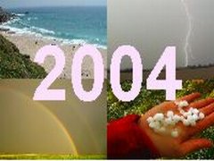 |
2004
- A Year In Pictures 2004 has been a spectacular year for weather in the UK. The EOTS team have seen it all, from tornadoes and violent thunderstorms, to hot summer's days, winter blizzards and stunning optical phenomema. This report displays some of the highlights of the year for us. Info: 23 photos. |
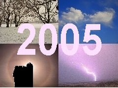 |
2005
- A Year In Pictures The second edition of our annual look back at the year's weather, and this time around it's the turn of 2005. Whilst storm chasing didn't quite live up to the previous year, 2005 shaped up to be another fantastic year for weather in the UK. Info: 38 photos. |
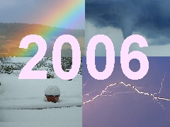 |
2006
- A Year In Pictures The third edition of our annual look back at the year's weather, and this time around it's the turn of 2006. The year provided storm-chasing galore, and some impressive snowfalls. The UK was visited by an ex-hurricane, and rainfall events were spectacular. Info: 60 photos. |
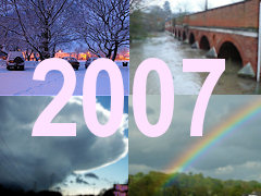 |
2007
- A Year In Pictures The fourth edition of our annual look back at the year's weather, and this time around it's the turn of 2007. The EOTS team's year was dominated by upheavel, moving house to the south-west of England before returning to the south-east. The weather was certainly varied, perhaps most notable for the heavy snowfalls early in the year. Info: 51 photos. |
 |
2008
- A Year In Pictures The fifth edition of our annual look back at the year's weather, and this time around it's the turn of 2008. It was another year without a decent summer but what it lacked in summer warmth it made up for in weather drama. Flooding was again on the menu and an early spring snowfall was an extra special treat. This report displays a few photos from each month of the year.. Info: 45 photos. |
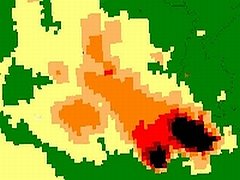 |
28th
April 2004 - European Supercell This report contains a radar analysis of a potential supercell thunderstorm which developed near Belgium in April 2004. The storm exhibits many textbook structures, including a splitting mechanism, right-moving and, at maturity, a hook echo. All radar images are strictly copyright the PA WeatherCentre. |
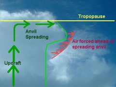 |
Spring
2003 - The Invisible Anvil This is a brief report examining a surge of air ahead of a developing cumulonimbus anvil. The photograph included has been annotated to help explain the phenomenon. |
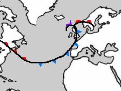 |
Explosive
Cyclogenesis Explained This educational report by Bren J is intended as a basic overview to the phenomenon of explosively deepening areas of low pressure. These dangerous and rapid storms have only recently been understood, and this report aims to illustrate how to spot these beasts using satellite imagery. *Link opens in separate window. |
 |
Fog
Rollers - Oceans In Fog In mid November, 2005, high pressure resulted in lots of low-level fog. Whilst giving grim conditions, a quick trip to the hills of North-east Wales allowed me to get into the sunshine, above the fog. Here, I witnessed an astonishing phenomenon, of large scale waves at the top of the fog. Read on for video, photographs and descriptions of this amazing sight. Info: 16 photos, plus 2 videos. |
 |
December
2006 - The Hundred-Hour Fog High pressure became dominant during the third week of December 2006, allowing fog to become widespread. In parts of the south-east of England, the fog persisted for just over four days, and freezing fog gave icing and rime deposits on trees. We spent a couple of days capturing some of the fog's charactistics. Info: 35 photos. |
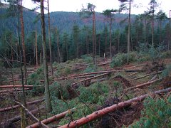 |
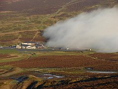
Massive
Tree Damage On The Clwydians Whilst on a country-walk on Moel Famau, the highest point on the Clwydian Range in north-east Wales, the EOTS team encounted some tremendous tree-damage. On further investigation, the damage followed a defined track which was not dissimilar to that of tornado damage? Was this a tornado? Was it something more? We present the evidence without a conclusion! Info: 17 photos. |
|
eye
on the sky 2001-2008
|
|