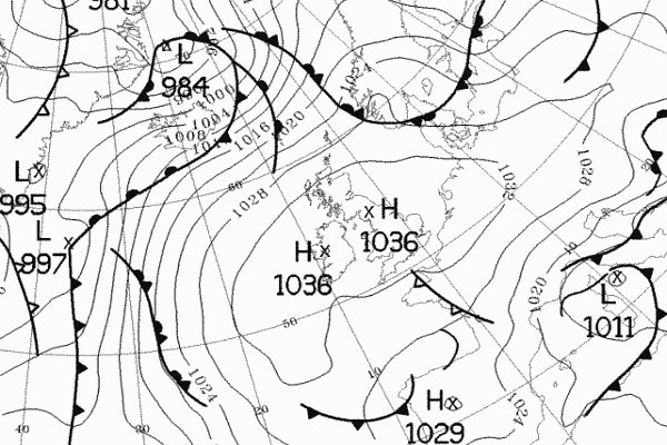
Below
is another synoptic chart showing the positioning of the high, this
time at midnight on the 22nd December:
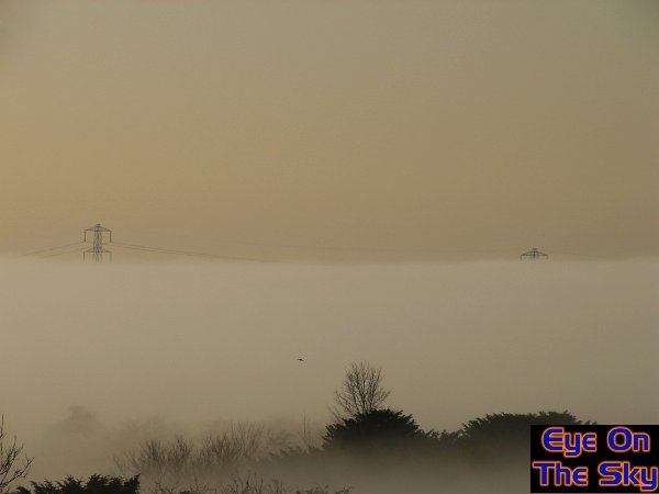
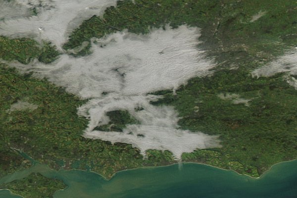
Below
is a satellite image showing fog at around midday on the 20th December.
On this particular day, the fog was quite patchy, but across Weybridge
(our home village) the fog hung around all day. Note how the fog is
butting up against the South Downs on this image, the ridge of high
ground just inland from the south coast of England. This image is provided
by the MODIS
rapid response satellite website.
By
the 21st December, Weybridge was into its third consecutive day of fog,
which had not cleared since the evening of the 18th. It was during this
day that the EOTS team decided to head to the high ground of the South
Downs in Hampshire and West Sussex. The aim was to climb above the fog,
actually enjoy some sunshine, and capture some of the fluid motions
of the tops of the blanket of fog.

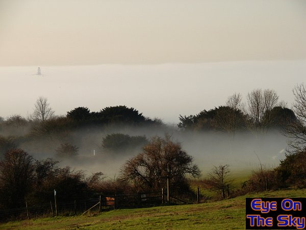
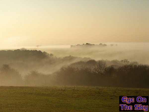
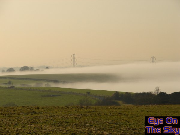
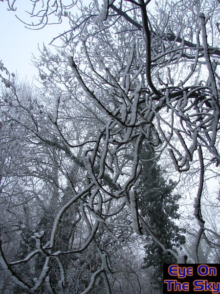
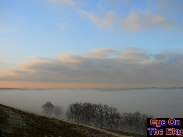
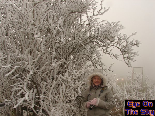
Below
the fog, heading through the valleys between the South Downs, scenes
were common but grim. The fog limited visibility to 100m at times, and
as the hedgerows to the left of this image show, the fog was dropping
rime ice in places.
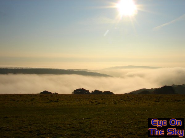
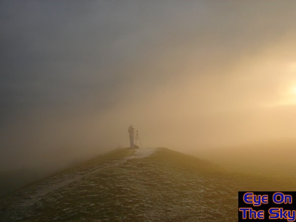
We
headed onto Butser Hill in Hampshire, one of the highest peaks along
the South Downs. Here, we broke into the sunny skies, and watched fog
cascading over the tops of lower hills to our east, into the valley
below.
As
a large amplitude fog wave rose out of the valleys below, it had enough
energy and momentum to roar over the tops of the Downs, oozing across
the fields.
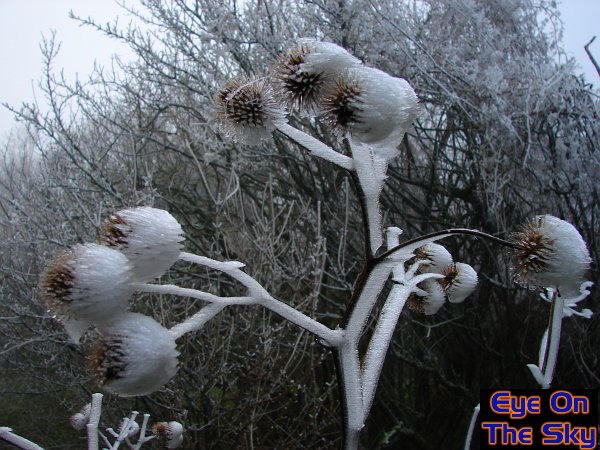
As
each wave of fog rolled over the tops of the Downs, it left supercooled
droplets clinging to vegetation in the form of rime ice. This is quite
rare in the UK too.
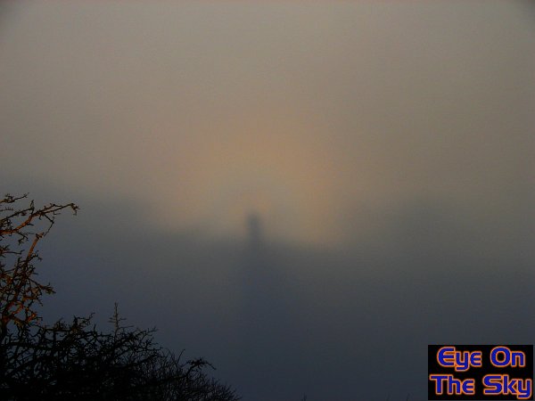
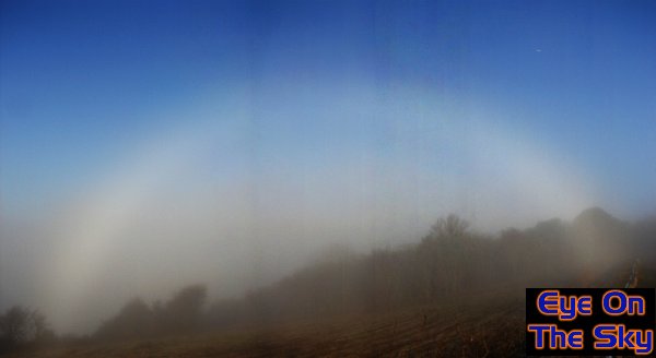
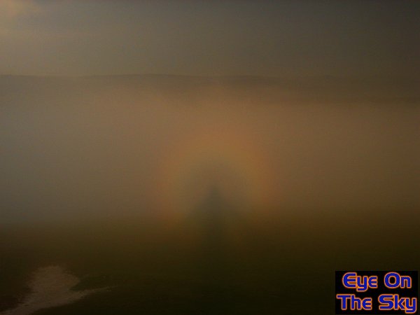
By
standing on a ridge with the sun behind us, we were able to cast a shadow
onto the banks of fog in the valleys below. Around our shadow, a Brocken
Spectre appeared, visible as concentric rings of colour around the viewer's
head.
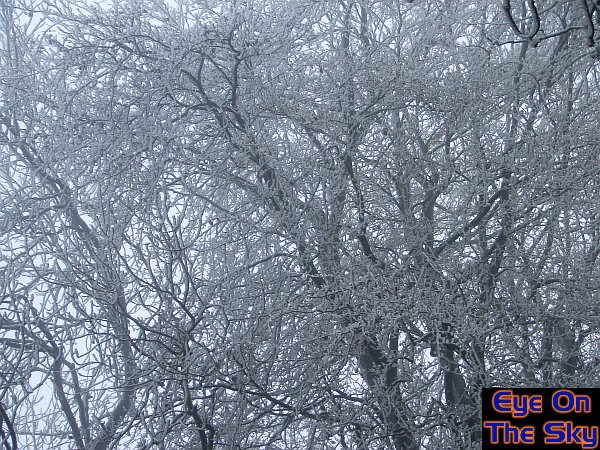
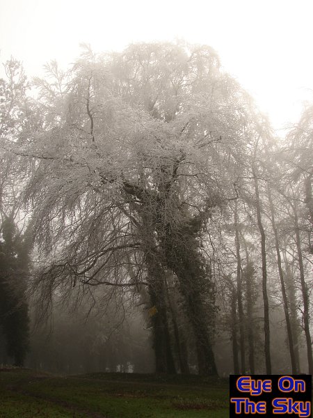
Back
into the fog, and on high ground near to the fog tops, rime icing and
more general icing was quite stunning. Here, trees are heavy with a
coating of solid ice.
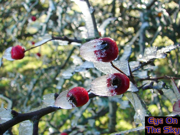
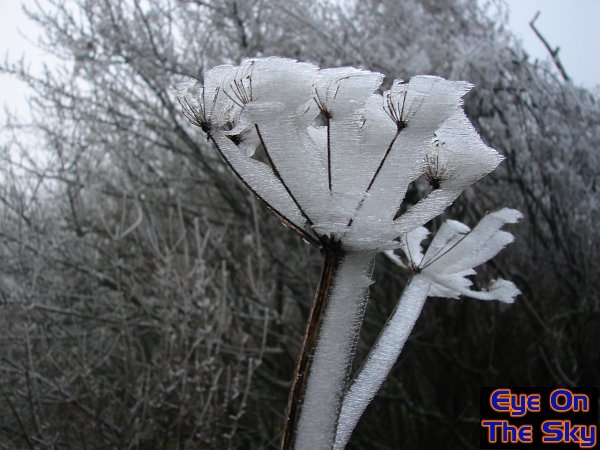
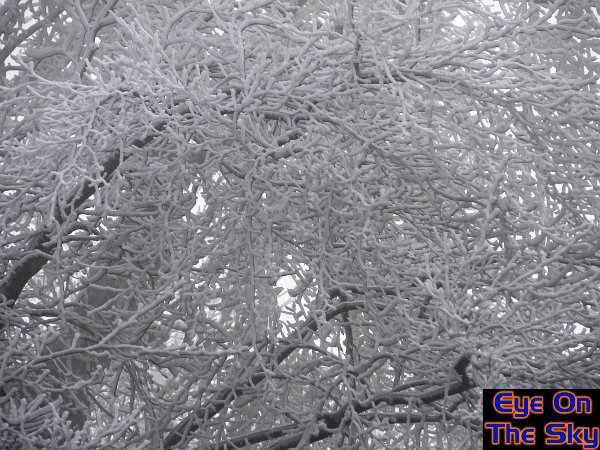
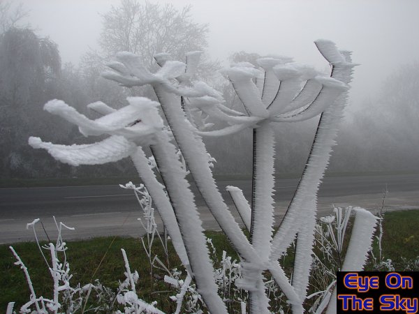
A
mixutre of rime ice and solid ice, clinging to trees on the Downs.
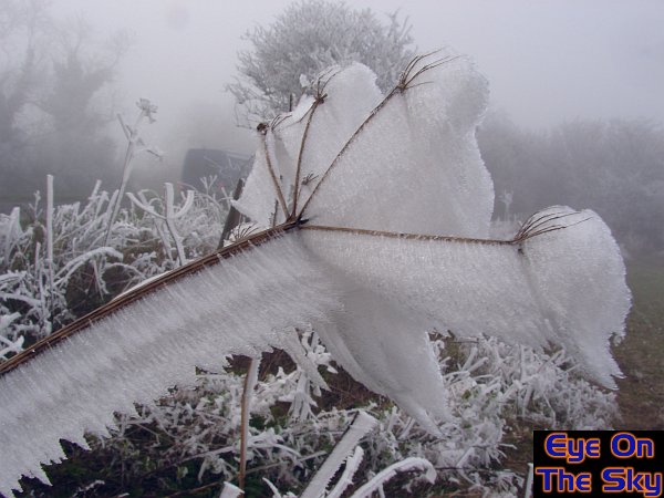
Nothing
was safe from the blowing fog, and thus nothing was safe from the deposition
of rime ice. The rime built up in the direction of the fog-flow.
Another
great example of the riming of just about everything the fog touched!

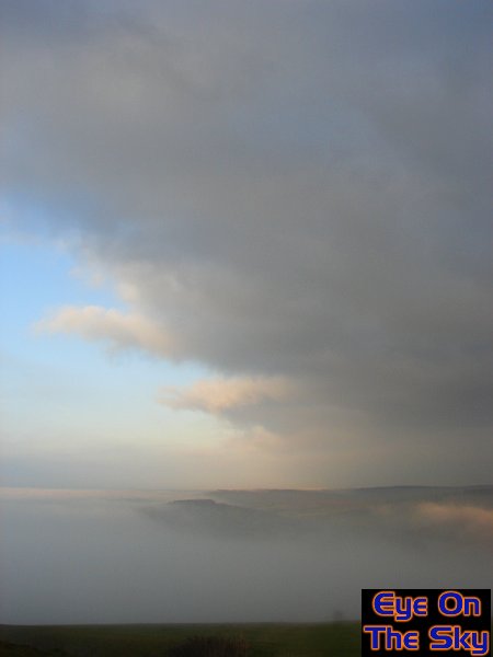
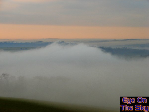
We
moved eastwards to the Trundle, another high peak along the ridge of
the South Downs, north of Chichester. Here, fog remains thick in the
valley below, but above, a layer of stratocumulus moved in from the
east.
The
same view a short time later, showing how the advancing cloud was forcing
the low-level fog to collapse as the air was warmed by the cloud blanket.
It
was pretty chilly on top of the Trundle, with fog occasionally breaking
over the top!
Another
impressive Brocken Spectre, viewed from the Trundle.

A
180 degree panoramic shot of the fog below,
viewed from west, through north, to east.
As
witnessed in north Wales back in 2005, fog
rollers were happily gliding past.
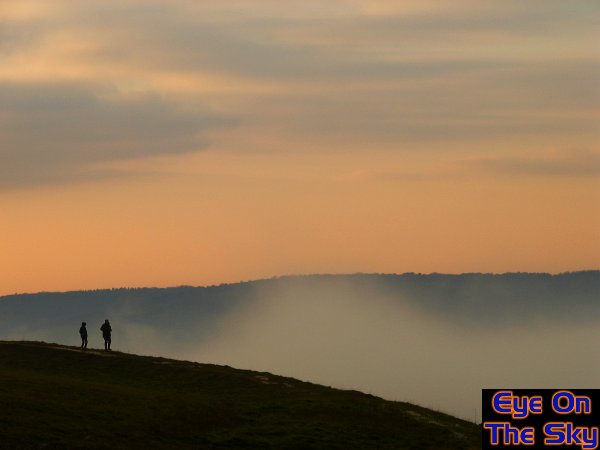
A
couple of brave souls watching the fog below at sunset.
The final shot on the 21st, with fog re-gathering down below at sunset.
On 22nd December, day four of the fog, we headed to the fog's southermost
edge, which was dammed up by the Hog's Back. This is a narrow ridge
which runs west to east through Hampshire and south-west Surrey. The
fog was freezing here, and we encountered some incredible rime icing,
as displayed in the next few photographs.
It was very much the tops of the trees subject to the heaviest rime.
A
closer view reveals almost snow-like accumulations. But this was not
snow -
it was rime ice accumulating out of the freezing fog.
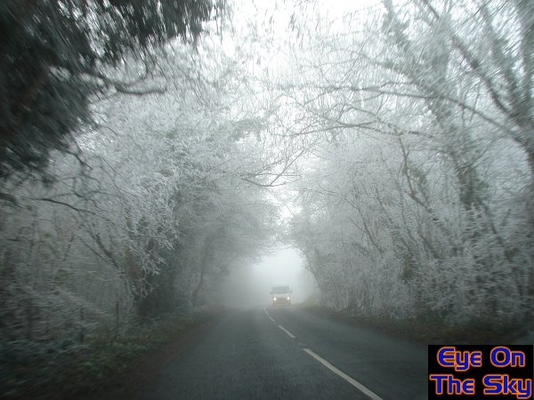
Roads
were clear of ice, but the surrounding trees, hedges
and walls were heavy with rime.

Trees
along-side the main Hog's Back road were heavy with over 2 inches of
rime, accumulating along with the wind direction. Even fences did not
escape.
The
trees with Laura in for scale. The headlights of her car are almost
faded out by the thick, freezing fog.

The
wind had allowed rime to develop in all manner of strange formations.
Here, the airflow around the horizontal fence bars created this horseshoe
of rime!
The
amount of rime on some thin twigs must have created considerable strain.
Another
example of the rime collecting on thin twigs, sometimes over 2-3 inches
deep.
Any finally, a few photographs from Weybridge on the afternoon of the
22nd December.

Traffic
was flowing ok, although the fog had yet to thicken.
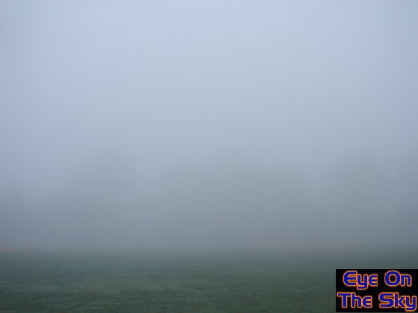
And
when the fog had thickened, visibility dropped to around 100 metres.

Fog provide a spooky foreground to the background sheet of grey.