2005
was a great year for weather, although the EOTS team were often unable
to chase the year's active thunderstorms due to other commitments.
The weather for 2006 was going to need something special to follow
its preceding year, and one way of doing this would be to provide
plenty of thunderstorms. The year did not only exceed expectations
- it blew them away! With too many thunderstorms to count, and not
to mention some of the heaviest snowfalls in years during March, 2006
will go down as one of the great years of weather for the EOTS team.
This
section sums up the year for us, by displaying a photo or two from
the most significant weather events we encountered during each month.
January
2006 - A
sugar-coating
The year started very mixed, with January
seeing a variety of weather types. Conditions alternated between high
pressure with local frost, to vigorous south-westerlies bringing in
mild but wet conditions. Here in the south-east, rainfall amounts
were small, and there was little photogenic weather for much of the
month. However, on the night of the 27th, a huge area of high pressure
to the north gave an easterly flow across southern England. In this
flow, a small cold front brought a brief period of light snow across
the south. This left nothing more than damp ground at low levels,
but a dusting of snow remained on the highest Downs into the 28th.
We visited Leith Hill in Surrey, where the following photographs were
taken.


February 2006 - A
chilly ending
Three dominant weather-types greeted the UK
during February, giving a wide range of conditions. After a cold start
to the month, conditions became milder around mid-month, with winds
swinging around to the west or south-west. However, an area of high
pressure became rooted during the last 10 days, giving north-easterly
winds. Whilst giving snow showers in northern and eastern areas, more
prolonged snow affected southern England on the 23rd. This was created
by a small low running in from the east, and gave a few centimetres
on high ground, and just a dusting on low ground. The photograph below
has been taken, once again, from Leith Hill. To see a video of the
light snowfall in Weybridge, visit our Skycam
archive and look for the 23rd February.

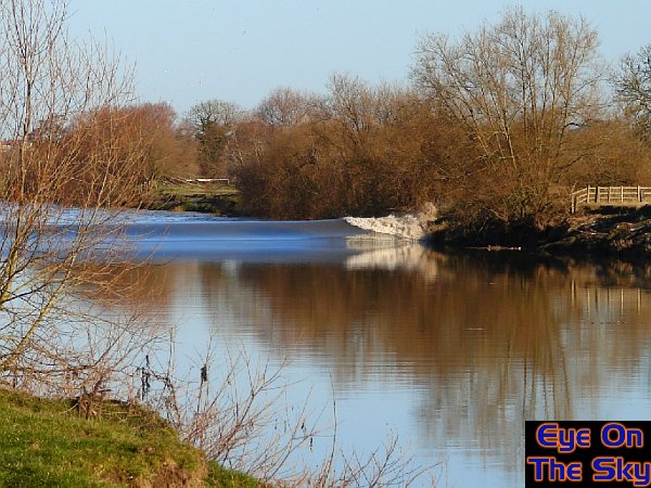
March
2006- Double
boring snowfalls!
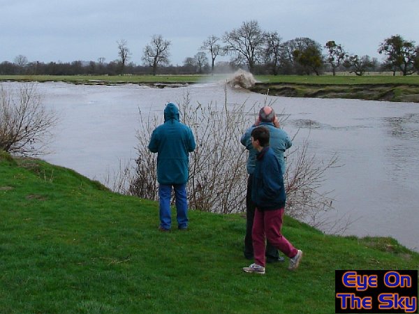
What a month! The quiet of January and
February was smashed as March arrived, with three river bores to chase
and some remarkable snowfalls across the country. In order of occurrence,
our first trip was to see the Severn Bore of March 1st. Lovely weather
conditions allowed perfect viewing of this 4* bore (first image).
Just two days later, Bren headed to north Wales to see the Dee Bore,
but got more than he bargained for. As well as seeing a nice bore
on the Dee (second image), he was also caught up in an epic Cheshire
Gap snowfall event, which blanketed localities in north-east Wales
with 2-3 inches of level snow (third and fourth photos). Next up was
a remarkable snowfall event on the night of the 11th. A warm front
attempted to move east into cold air, bringing heavy snow for north
Wales, north-west England and Scotland. Although not in Wales at the
time, the EOTS team were sent images of the 6-7" of level snow
which fell (fifth image). For more photos of these snowfall events,
please see
here. Lastly, there was another impressive Severn Bore
at the end of the month, which we went to visit. A flooded river gave
an interesting bore which over-topped the banks in places (sixth and
seventh photos).

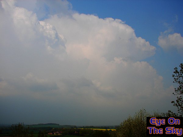
April
2006 - Early
taste of summer
The start of April was very unsettled,
with active frontal systems giving rain or showers. Conditions became
wintry too around mid-month, with snow in places. However, at the
end of April an area of high pressure gave fine conditions across
the UK. The best of the sunshine was in the west, and the EOTS team
were on a camping trip in Pembrokeshire, south-west Wales. Almost
unbroken sunshine for three days gave summer-like conditions for our
trip, when the first sun-tan of the year developed! It was a little
chilly in the evening's though, especially in a tent. The photos below
show scenes of that fine weather.

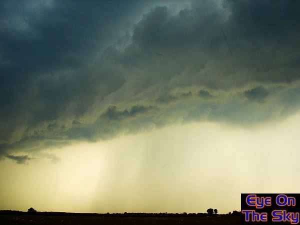
May 2006 - The
first chase : Reading Monsterstorm
With the arrival of warmer summer weather,
it was just a matter of time before the first thunderstorms of summer
developed. We didn't have to wait long, as we were off chasing on
the 10th. An isolated thunderstorm developed during the afternoon
to the north-west of London. Within an hour, this had become the
Reading Monsterstorm. A single, massive cell slowly threw-out newer
cells, and in no time at all, a gigantic multicell thunderstorm
rumbled westwards along the M4 corridor. The EOTS team met up with
fellow thunderstorm chasers, and kept up with the storm from west
of Reading, to the coast at Weston-super-Mare. Here are some images
of that epic storm chase, and you can see video footage in our video
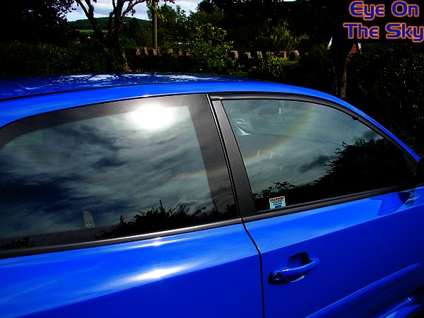
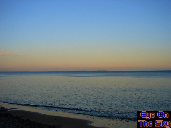
section. The weather became fine towards the end of May,
and in north Wales, it was perfect conditions for washing the car.
As seen in the last image below, it was also the right conditions
for haloes, which reflected nicely in clean car bodywork ;-).
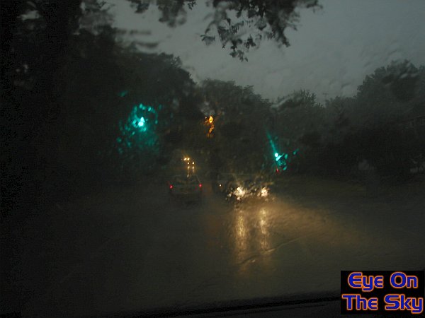
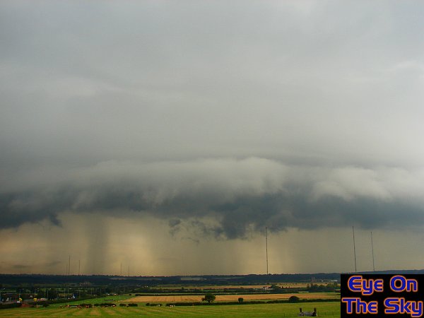
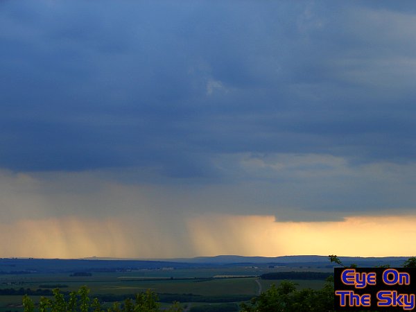
June 2006 - Summer
'n' storms
The summer became better and better,
with plenty of hot sunny days, and plenty of decent thunderstorms.
Two noteworthy storm chases included, firstly, the 4th May, when the
EOTS team took a trip to Wiltshire to watch approaching storms. Although
lightning was sparse, interesting cloud formations made for a great
chase, including a possible wall-cloud. See the first and second images
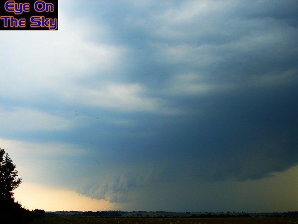
for this Wiltshire storm. The next storm chase took us to Lincolnshire
on the 12th May, for what turned out to be one of the more memorable
storms of 2006. Now known as the Lincolnshire Uberstorm, we witnessed
a stunning display of gust-front action, and very frequent and violent
cloud to ground lightning. See images three to six for this Lincolnshire
thunderstorm, which includes a stack of hay which took a direct lightning
strike! For both chases, vist our video
section for more. The
last image for June shows some of the perfect sunny weather that often
goes hand-in-hand with thunderstorm activity. This image was taken
by the river Wey near Ripley, Surrey.


July
2006- Chase
Florida and kick-ass English storms
The first fortnight of July was spent trawling
the Florida peninsula in the US, searching for thunderstorms. Most of
the time, they searched for us. Not one day passed during the fortnight
without something thunderous breaking out. The first two images show
just some of the things we witnessed. For an in-depth account of our
trip, visit our chase
section. No sooner had we returned from Florida to England,
we were back on the road searching for the UK's natural fireworks. We
found them, and then some! Our first chase was on the 26th July, and
we travelled to East Anglia and Lincolnshire with a fellow chaser. After
a day of moderate thunderstorm activity, we ended with quite a severe
thunderstorm. We witnessed flooding, large hail, frequent lightning
and damaging straight-line winds. Images three to five below show some
scenes from the day. The next storm was just 24hrs later, and broke
out over Weybridge. This amazing thunderstorm continued to back-build
across the town, and as a result, we received around 3hrs worth of torrential
rain. Flooding brought chaos, damaging homes and roads. Lightning frequency
was also second to none, and we witnessed daytime darkness. See images
six to eight below. Once again, footage of all the storms during July
can be found in our video
section. The
hottest day in the UK during the whole of 2006 was at Wisley in Surrey,
on 19th July. It just so happened we were walking around Wisley at the
time, during the 36.5C sizzler (last photo).
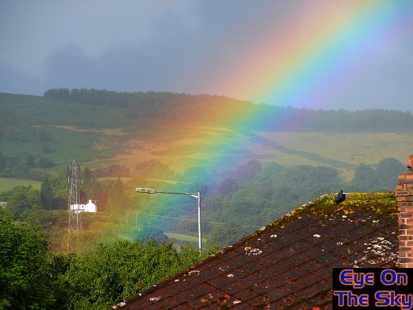
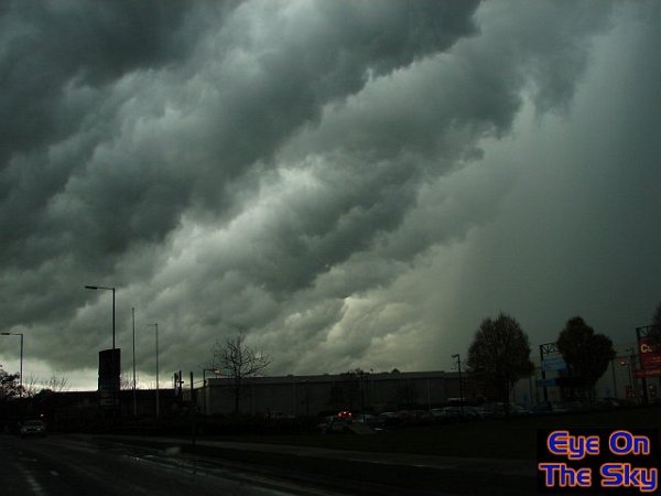
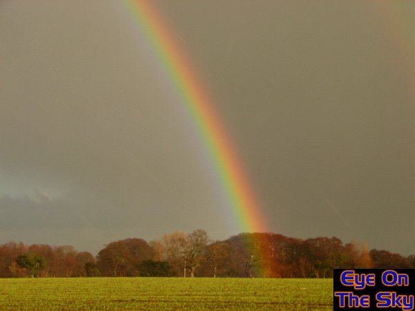
August 2006 - Storms,
showers and shrooms.
After a record-breaking July in terms of summer
heat, August was disappointly cloudy and wet for many areas of the UK.
There were still some sunny days, although they were few and far between.
The damp and cool conditions were enjoyed by some though, as the early
toadstools in north Wales showed (first image). When the sunshine did
appear, it was often broken by showers. It was rainbows galore, as the
second below image testifies. There were some thunderstorms during the
month, but on the 18th, Bren chased a particularly impressive storm
through the east Midlands. This squall line gave spectacular gust front
scenes, and plenty of road flooding. See the third and fourth images,
and also visit our video
section for
more. The last image in this month was taken at Wisley Gardens in Surrey
- just to prove there was some summer to be had during the month!
September
2006 - Gordon
and the bore
Unusually high tides were predicted for the
UK's coast during the first few days of September, and for us this
could only mean one thing - tidal bores. Being a weekend, we decided
that the Severn would be too crowded, so headed to see the Dee Bore
in north-east Wales on 9th (first image). Weather conditions were
fine, so the bore wasn't spectacular, but as the days shortened into
autumn, misty mornings with low-lying fog were apparent (second image).
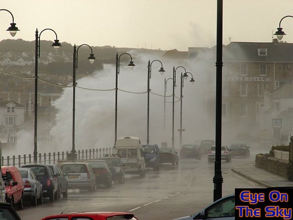
The final weather event in September was the arrival of a vigorous
area of low pressure, that was created by hurricane Gordon. The hurricane
had lost its tropical status only 36hrs before hitting the UK! The
EOTS team headed to Cornwall to welcome Gordon during the afternoon
and evening of 21st September, and witnessed howling 60mph winds and
mountainous seas.
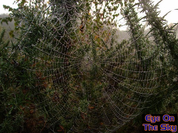
October
2006 - Autumn
quietly arrives
The exceptionally warm September continued
into October, and autumn-proper was kept at bay. However, the signs
of autumn slowly crept in as the month progressed - a month dominated
by fairly quiet but pleasant sunny days. Toadstools were prolific in
the damp conditions, such as the poisonous Fly Agaric in the first image
below. Morning dew was heavy in the damp conditions, lining trees and
spider's webs, as seen in the second image. Fog wasn't widespread, but
there were a few foggy episodes. One such fog was mid-month, but as
shown in the third image over the river Wey, it wasn't particularly
thick. This more autumnal, if still very mild, weather allowed trees
to finally start their autumn plumage. As seen on the fourth image,
the leaves were still green, but many had fallen off, carpeting the
floor with orange. The last day of October was breezy. Whilst not hugely
windy, it was still enough to push over a tree which uprooted just yards
from where we were walking (last image).
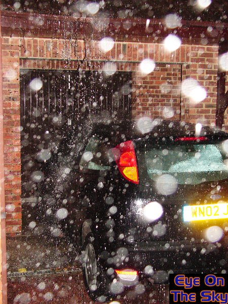
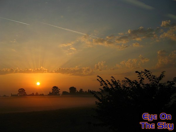
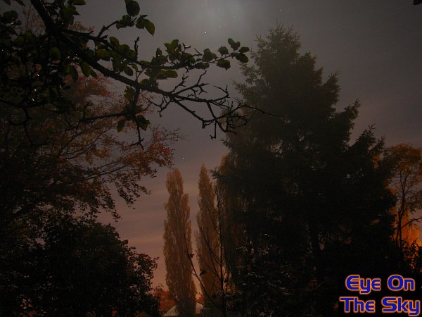
November 2006 - Beauty
& damage of the warm variety
The
theme throughout the whole of November was unseasonably mild conditions,
merely extending the year's record warmth across the UK. The month started
relatively quietly, and on the 5th November, a stunning sunset was witnessed
country-wide. We viewed it in North Wales, as the first image shows.
These settled conditions also led to beautifully clear nights, with
patches of fog coming and going. The second image below shows a night-time
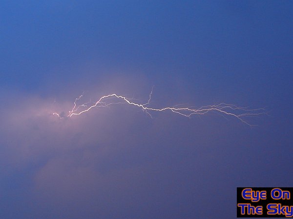
shot in North Wales. The end of November saw dramatic thunderstorms
across much of the UK. Lightning frequency and storm intensity was more
akin to storms seen in the summer, but with such unusual warmth and
moisture in the air, it came as no surprise. One storm in Weybridge
on the 26th dumped hail which was large enough to damage the EOTS team
vehicle! For more information on this, please visit our chase
section.
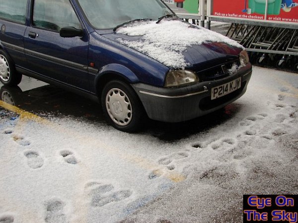
December
2006 - Finally
colder!
After the ridiculously mild autumn, Decemer
finally brought something a little more seasonal. In north Wales on
December, a north-westerly brought plenty of showers, and these fell
as small hail and sleet (see first and second photographs). These
were hot on the heels of the very wet weather during the first part
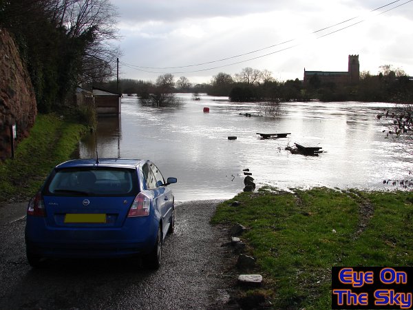
of the month, which saw the River Dee in north Wales burst its banks
(third image). The third week of December saw high pressure, and the
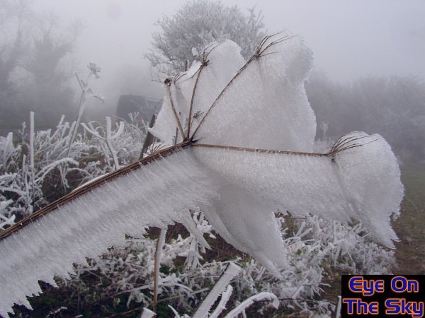
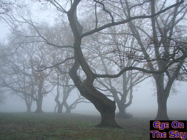
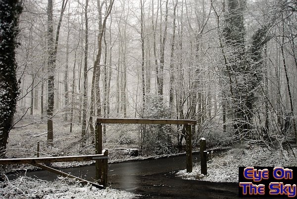
arrival of widespread fog, rime ice and frost.
Will
2007 be a weather year to match that of 2006? Here's hoping......

Copyright
eye on the sky 2001-2008
|