|
>Fog
Rollers pictures
Denbighshire, NE Wales 22nd November 2005 |
||
|
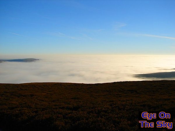
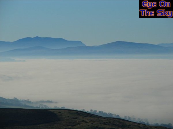
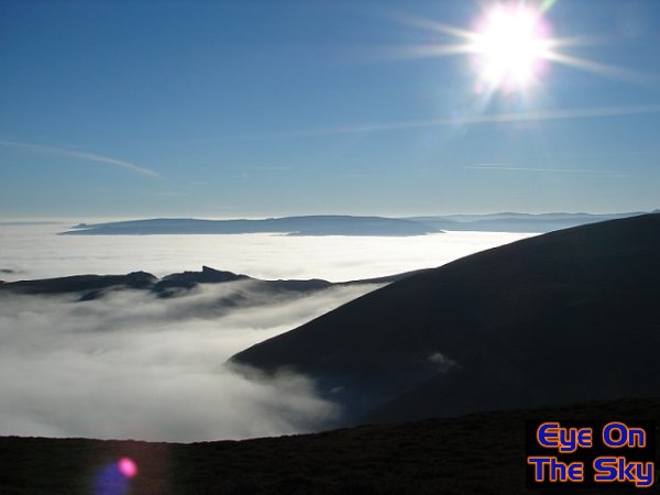
However, the nature of low-level fog means that just a few hundred metres above the surface, it can be crystal clear with sunshine. On the 22nd November 2005, I used this notion and headed onto the Horseshoe Pass in Denbighshire, north-east Wales, which rises to around 500 metres above mean sea level. Sure enough, the steady climb to the summit soon revealed a sea of fog below me, and the result was like looking out of an aeroplane window!
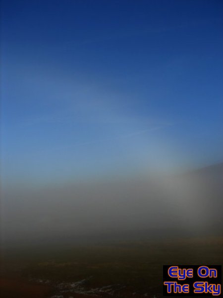
Whilst climbing to around 500m asl, from the main carpark areas at 400m asl, I managed to get myself into position to witness some amazing fog-related phenomena. With the sun behind me, I was able to observe the equivalent of a rainbow cast in distant rain. This time however, the moisture was in the form of fog droplets, and this created a fog bow!
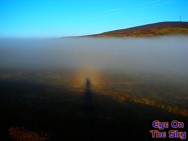
Another classic optical affect to look for when viewing fog, is that of the 'Brocken Spectre'. This appears as a halo of light around the observer's head, provided that your shadow is being cast onto a passing fog bank. For maximum effect, you need to be in clear air, without any fog obscuring the sunshine behind you.
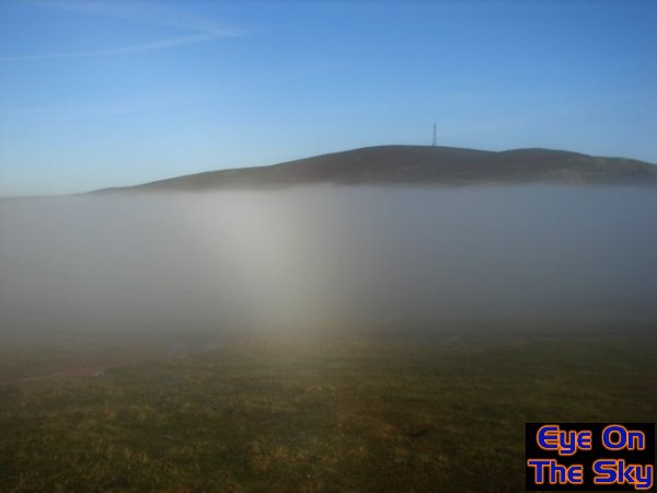
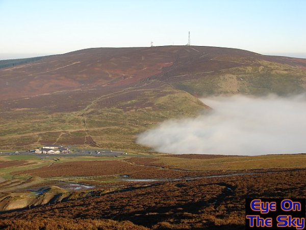
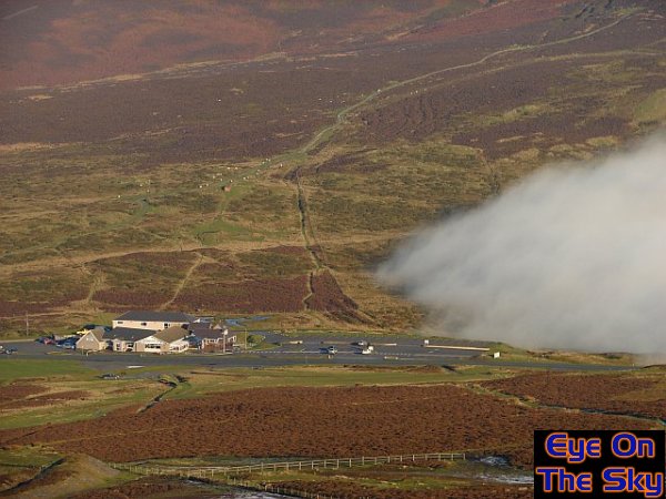
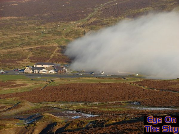
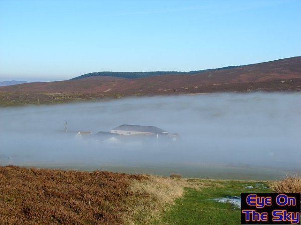
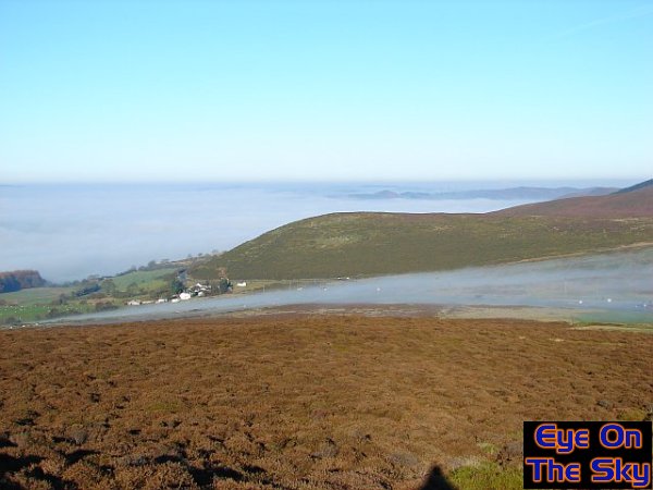
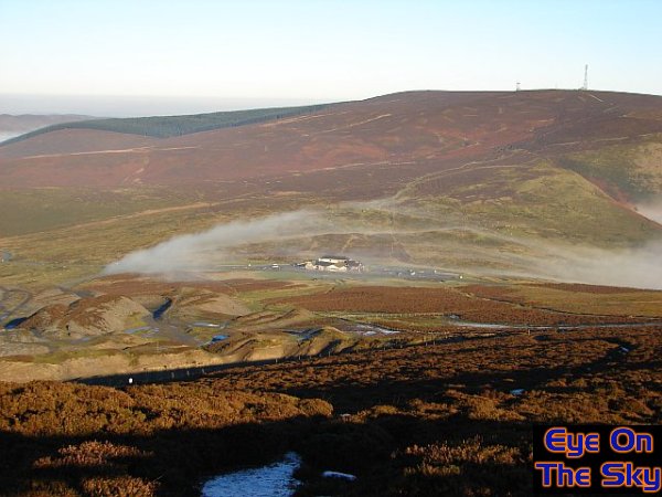
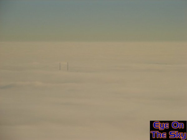
These are a few weather optics I'd never seen before, so I was delighted to capture them. However, my next discovery was altogether more captivating. The top of the low-lying fog was uniform and flat, as the earlier images show. However, large bulges could be seen in the fog, separated by a few miles or so. These 'lumps' in the fog spanned from horizon to horizon, and were moving from east to west. My location was at the head of an increasingly narrow valley, and I observed these lumps of fog working their way up the valley, like waves in a bay. In fact, when they reached the head of the valley, I realised that waves were exactly what the fog-top was displaying! The following account shows actual images of these fog waves, compared with schematic drawings I've compiled to explain the phenomenon. The base-state, or starting position, was that of fog trapped in the valley below me. The plateau seen in this image was around 420m asl, and was a narrow, joining ridge between two higher peeks. The building and car-park of the visitor centre are clearly visible.
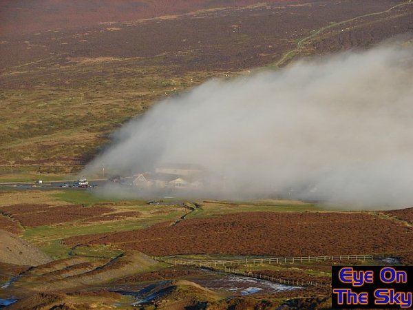
Finally,
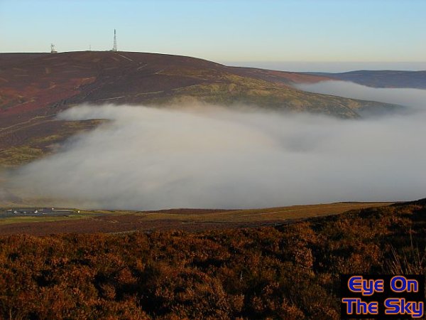
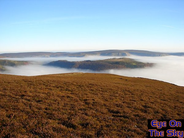
the wave disperses, with the rear of the wave sinking back into the
valley from which it came. In this image (below) the forward edge of
the wave is still clearly visible, whilst the fog following on disperses
and returns to the valley. For a much more fluid (pun intended) view of this wave in action, please have a look at the following video. As well as containing a more comprehensive schematic view of the waves, it also contains timelapse photograph of the actual waves. When speeded up, the true ocean-like structures of these waves can be appreciated. Video
details: Lastly, here are a few more images from a truly amazing day above the clouds.
Copyright eye on the sky 2001-2008 |
||