For
Bren and Laura, 2004 was an exciting year weather-wise. During the
course of the year, we covered in excess of 5,000 miles travelling
around the UK in search of the best weather events this country had
to offer, and we were not left disappointed.
This
page sums up the year for us, by displaying a photo or two from the
most significant weather events we encountered during each month.
Just remember one key fact if you want to see exciting weather....
the weather's not there for you, you're there for the weather! Go
get it!
January
2004 - Yorkshire
Snow
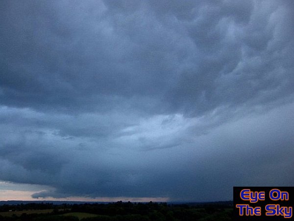
A cold northerly blast swept across the
country towards the end of January, blanketing many central and eastern
parts with snow. Thundersnow was witnessed in many parts of England,
but we'd headed to North Yorkshire for a weekend. 48hrs of snow, and
several stranded episodes on the North York Moors later, our trip
to a snowy Yorkshire was the highlight of our weather year! We also
filmed the whole weather event for BBC's Countryfile, which was aired
last spring. You can view the various videos in
our video section.

February 2004 - Snow
In Slough!
An isolated snow shower roared in across Slough
(when we were still living there) during a morning mid-month. Nowhere
else in southern England saw the same shower, which developed near
Northolt and become huge as it moved overhead. The snow shower gave
about half an inch of solid cover in less that half an hour, before
crisp, blue skies returned from the north-east.

March 2004 -
Filkins "Supercelll
& Tornado
The now infamous storm which is our largest
storm-chasing prize to date, this isolated, severe thunderstorm in March
has now all but been accepted as being a low-topped supercell. Although
it'll never be proven without Doppler radar, everything else about this
storm in Oxon screamed 'supercell'. The cloud structure, with its streaming
anvil radiating from central core (first picture), frequent and vivd
lightning, large hail (see second photo) and many other characteristics
were awe-inspiring to watch. As we were watching the storm, just a mile
away a tornado was ripping through the villages of Filkins and Broadwell,
causing significant damage (see last couple of photos). A truely monsterous
storm! Full report in
our special supercell report.
April
2004 - Worcester
Megastorm
After a whole day's chasing, which took
us from London to Derbyshire, we eventually ended up all the way down
in Worcestershire. The distance was worth it though, as we encountered
one of the best thunderstorms of the year. The system became multicellular,
perhaps even an MCS, and grew to fill most of the west Midlands. It
was as close to a Spanish Plume storm that we had in 2004, with almost
nil sky visibility, deep purple skies, ongoing torrential rain and
vivid lightning. Sadly, we took few photographs, so this CG is actually
an analogue video capture. To view a short video of a near miss with
lightning, visit our video gallery.

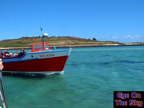
May 2004 - Cornwall's
Sunniest May
High pressure over the UK gave south-west
England the sunniest May for many decades. By chance, we were holidaying
in the area, firstly backbacking around the Cornish coast path,
and then spending a week in the Isles of Scilly. We had wall-to-wall
sunshine, without a cloud in the sky for 14 days, although there
was some patchy sea fog. This first photo shows people basking on
golden Cornish sands, whilst the second image shows a small off-islands
ferry in the Isles Of Scilly.
June 2004 - Thunderstorm
Structures!
Plenty of showers and thunderstorms affected
southern parts of England during the month of June. This storm, roaring
in to the south of the North Downs near Guildford exhibited superb
structure. On this photo alone, there's a marked gust front lowering
towards the ground on the left of the image, complete with gustnadoes.
There's also a well-defined precip downdraft behind this, and mammatus
bulging from the streaming anvil.
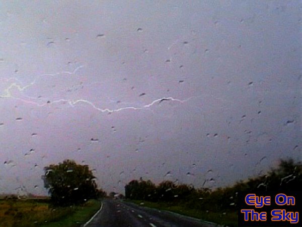
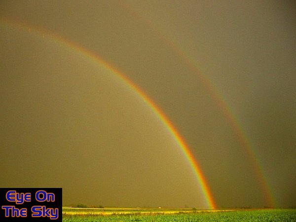
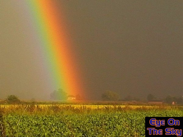
July
2004 - Lincolnshire
Thunderstorm
Our chasing exploits took us to the Plains of
Lincolnshire, where we intercepted a cracking summer thunderstorm.
Amidst torrential rain, lightning every ten seconds or less, and superb
cloud structures, we managed to get some great images. Here's just
a couple, including a lightning bolt as we neared the storm's core,
and a double rainbow as the solid rain sheet moved away.
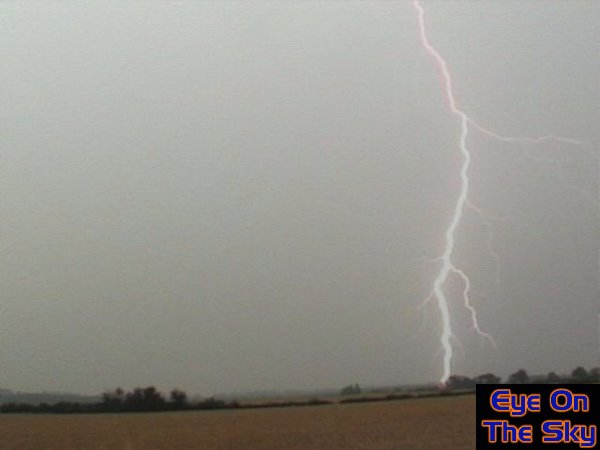
August 2004 - Swindon
CG
An explosive couple of days across southern parts
of England, as thunderstorms let rip. One particular storm, which we
intercepted, was over Swindon, and we were able to get some great footage
of cloud-to-ground lightning strikes just a few fields away from us!
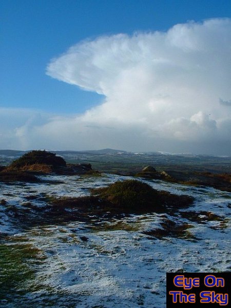
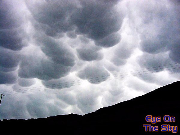
September
2004 - Welsh
Mammatus
During mid-September, we embarked on a storm
chase to the west Wales coast. Meeting up with fellow storm enthusiast
John Mason, we didn't actually see any lightning or thunder. However,
as the remnants of a large storm moved overhead, we captured some
of the most stunning anvil mammatus we've ever seen!
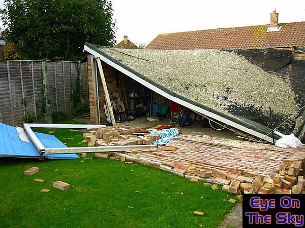
October 2004 - Felpham
Tornado
During the early hours on a mid-October
morning, we were woken by a violent thunderstorm passing over Weybridge,
as the centre of a low pressure area and triple point moved directly
overhead. Only hours earlier, the same storm system produced a number
of tornadoes, including one in Felpham near Bognor Regis, on the south
coast. Here, a garage lies in ruins after being ripped apart by the
tornado, whose windspeeds exceeded 100mph during it's trail of destruction.
Notice how the blue garage door has been blown inside the garage,
then forced outwards through the garage wall and onto the garden lawn.
The door used to be at the right-hand side of the garage, where the
roof is now in contact with the ground.
November
2004 - Early
Snowfall
The latter part of November was fairly cold,
with some widespread evaporative snowfall across north Wales and the
Midlands. We were also lucky enough to see some snow here in south-west
London, although we had to venture onto the highest reaches of the
North Downs to see it actually accumulating.
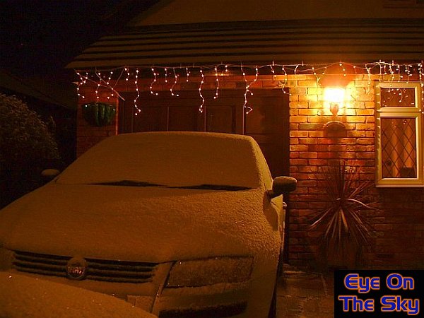
December
2004 - A
White Christmas
As winds turned northerly for one day only,
2004 could not have finished in a better way! The classic Cheshire
Gap opened up North Wales to frequent snow showers through Christmas
Day and overnight into Boxing day morning. As well as a few centimetres
of snow, I saw stunning clouds, thunder and lightning, hailstones
and beautiful blue skies.
Copyright
eye on the sky 2001-2008
|