After
the epic storm-chasing year of 2004, it was always going to be difficult
to even come close in 2005. In terms of storm chasing, the EOTS team
were unable to chase on numerous occasions, despite there being plenty
of activity. However, we did capture some thunderstorms, and there
were plenty of exciting weather events during 2005, making it another
memorable weather year!
This
section sums up the year for us, by displaying a photo or two from
the most significant weather events we encountered during each month.
Eyes are already looking to 2006, and the weather-goodies that may
bring. With a storm chasing trip planned in Florida, it's looking
good so far! But for now, here's 2005.
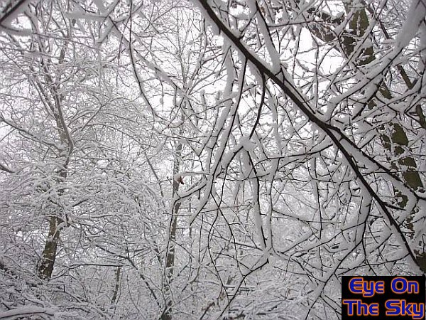
January
2005 - Snow
showers
January was a quiet month in terms of
weather-watching. However, during a couple of days of northerly winds,
wintry showers managed to drift southwards across many eastern areas
of the country. These mammatus clouds below were billowing from a
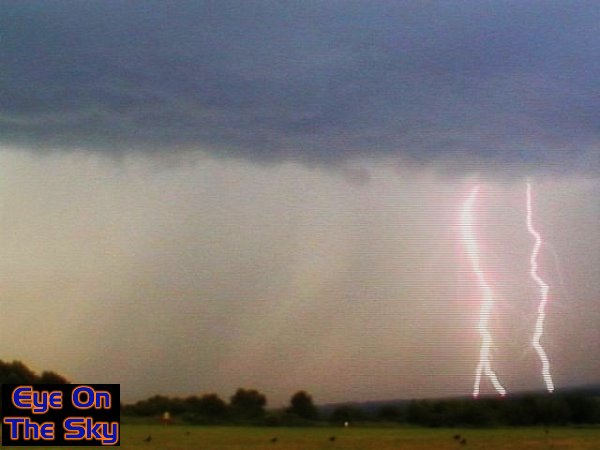
snow shower over London on 24th January. Bren managed one snow chase,
across Norfolk and Suffolk (England) too. During this, he managed
to locate a hail and snow shower which was electrified. Perched on
a small hill in the middle of the open plains of East Anglia, the
build-up of charge before each lightning bolt played havoc with the
car radio. The see a video of this phenomenon, please
click here (1.6mb - 2:15).

February 2005 - Decidedly
snowy
A
pleasantly wintry month, with some decent falls of snow in the south-east
of the UK. By decent, that's nothing more than an inch or two of cover,
but in these days of precious little snowfall, that's better than
nothing! The following images show snowfall on 24th February, firstly
in Weybridge, and then on Leith Hill in Surrey. A couple of inches
fell on the higher ground, whilst the snow in Weybridge had disappeared
by the evening time.

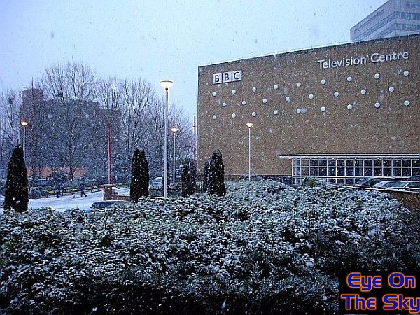
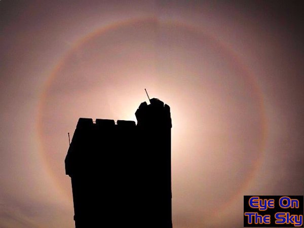
March 2005-
Say halo to the snow
Amazingly, the snowfall in late February
would start a long spell of daily snow in London and the surrounding
areas, mostly in the form of showers. Whilst most of this didn't accumulate,
it marked one of the longest periods of daily snow in the area for many
years. The first image here shows another fall of snow at the BBC in
London, on March 4th. Milder, more spring-like conditions had arrived
towards the last week in March, and during another trip to Leith Hill,
the EOTS team captured one of the brightest, most complete haloes we'd
ever seen.
April
2005 - Spring
thunderstorms
With warm weather arriving, it was only
a matter of time before the thunderstorm season commenced. Indeed,
on 19th April, a trough moving up from the south, driven on by low
pressure to the south-west, brought with it some very thundery activity.
The focus for the day's action was south Wales and south-west England,
and the EOTS team spent the day racing around Devon and Somerset.
Below are 3 images taken from the day, including driving into a storm,
leaving behind a storm, and a stunning rainbow to end the day.
May 2005 - Optical
showers
May was generally a quiet month in
terms of weather chasing, although the transition between spring
and summer did bring with it some impressive showers. It was a month
to study the types of weather which rarely make people gasp, but
when captured in the correct way, are just as beautiful. On 8th
May, after a day of sharp showers, another large cell starts to
develop to the east of Weybridge, looking over the Thames (first
picture). We also snapped a timelapse of these clouds, which can
be found in
our video section. The second image is of a rare circumzenithal
arc and halo, which was captured on the 26th May in rural Surrey.
Lastly, some amazing cirrocumulus formations were captured in North
Wales, just before the end of the month.
June 2005 - Let
the storm chasing commence
As far as we were concerned, the summer
had now well and truly arrived, as we engaged on numerous storm chases
across the country in June. These chases included Lincolnshire on
3rd June, where we managed to get right beneath a developing thunderstorm
(images 1 & 2, also see our
video section for timelapse of thunderstorm). Another storm
event saw Laura chase down to Hampshire, where she caught an amazing
display of lightning, courtesy of high based storms (images 3 &
4, also see our
video section for "Lightning
Fest"). On 28th June, one high based storm paid a visit to Weybridge,
and whilst not looking spectacular (last image) its multiple lightning
strikes and curious gargling, high-based thunder, were superb.
July
2005- A
few storms and a holiday
Another quiet month for storm chasing once again,
mostly due to work commitments than anything else. That's not to say
there weren't any storms of course, and this first image shows one
thunderstorm trundling its way along the south coast of England. At
the end of July, was the huge tornado which practically devastated
parts of suburban Birmingham. However, the EOTS team were blissfully
unaware, and holidaying in Menorca. The last two images here show
some 'jellyfish'altocumulus castellanus, and also one of Menorca's
fine beaches.
August
2005 - Frontal
shelves and CGs
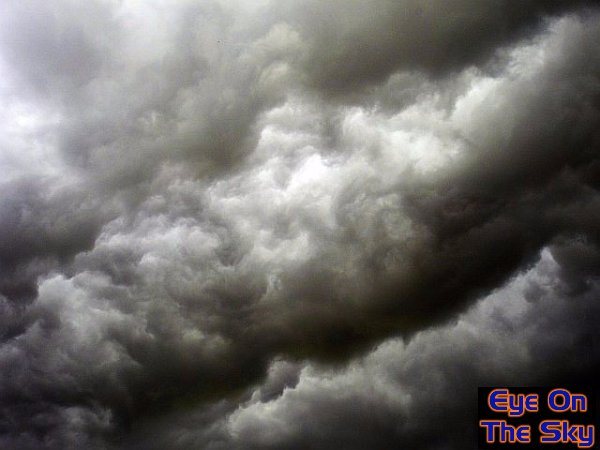
August settled down into a rather cool and unsettled
month, although there were a couple of warm interludes, courtesy of
Spanish Plume events. The first image shows the passage of a cold front
on 24th August. As well as being spectacularly lit by the setting sun,
the surface cold front resembled a stunning shelf cloud as it moved
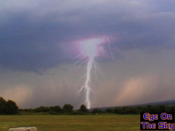
away. Mid-August, and more storms developed along the south coast. Bren
was there, and caught some tasty CC lightning on video capture. On the
very last day of August, a particularly impressive outbreak of thunderstorms
saw some of the most electrically active, high-based storms we've ever
seen in the UK, with lightning rates of one discharge every 5 seconds
or so (see second image).
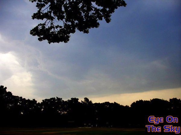
September
2005 - The
weather takes a break
September
started with a bang, as violent thunderstorms moved up from the south
on the last 'Spanish Plume' of the year. However, poor visibility
and night-time storms made for poor footage. For the rest of the month,
conditions were quite quiet, but that's not to say there weren't any
interesting photo opportunities around. This sole image from September
shows some interesting cirrocumulus formations over Reading, Berkshire.

October 2005 - Eclipse,
optics & gusters
The month started with a non-meteorological
phenomenon, but at least the weather was kind enough to let us see
it. An annular eclipse could be seen across southern England, and
we used some semi-transparent plastic to allow us to photograph it.
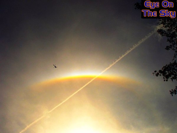
On 10th October, whilst walking in the Surrey countryside, the most
amazing sundog developed in front of us. We were in the right place
at the right time, as a 'jellyifish' of high cirrus refracts the sunlight
perfectly! Towards the end of the month, active thunderstorms rumbled
up from France as conditions became very warm for the time of year.
We snapped a scary-looking thunderstorm over Clapham, London, which
included a raging gust-front, and also a short-lived funnel cloud
(all taken on a camera phone).
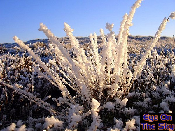
November
2005 - The
anticyclone
The
start of November was uneventful, and not great for photography. However,
by the 17th, northerly winds allowed the first wintry precipitation
across south-east England, with soft hail amongst the showery falls.
For the rest of November, high pressure dominated the UK's weather,
resulting in one of the frostiest and foggiest spells for many years.
Wisley Common in Surrey looked so different just 2 days apart, firstly
bathed in autumn sunshine and mist, followed by freezing fog and a
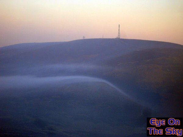
heavy hoar frost. Right at the end of November, whilst in North Wales,
Bren observed a stunning phenomenon in widespread fog. As the fog
reached the Welsh mountains, it lapped up against the peaks in waves,
just like those seen in the ocean. To view videos and a report of
this, our
video section.
The fog also produced optical effects, including fow bows and a Brocken
Spectre.
December
2005 - Frozen
hills and fiery spaceships
As
Christmas approached, we headed up to Yorkshire for a long weekend,
to bag the Christmas shopping. Whilst there, and on a visit to the
North York Moors, we were treated to a stunning lenticular cloud display
at sunset. Between Christmas and New Year, we headed back to the Horseshoe
Pass in North Wales (as seen above surrounded by fog). Whilst walking
on the hill tops at dusk, temperatures plummted to -7C, and hoar frost
became very thick, very quickly. We also observed dense air pouring
off the tops of the hills and down into the valleys, visible by thin
banks of fog streaming downhill.
Will
2006 be a weather year to match that of 2005? Here's hoping......

Copyright
eye on the sky 2001-2008
|