Here's
the next installment of our annual look-back at the year's weather
in the UK. This time, it's the turn of 2007, a year which would bring
huge weather disappointments to some and blasts from the past for
others. A move to south-west England saw an effective storm drought
for the EOTS teams, with one of the most thunderless years for a long
time. However, wintry events earlier in the year gave widespread snowfall
on a scale not seen for many years.
This
section sums up the year for us, by displaying a photo or two from
the most significant weather events we encountered during each month.
January
2007 - Chaos
from all corners!
The month was generally very mild indeed,
with unsettled conditions rattling in from the southwest on numerous
occasions. The first major weather event was a severe gale which swept
southwest England on the 11th. Bren visited the southwest, where Laura
was now living, in time for this gale and spent an afternoon on Devon's
coastal headlands. The first image below shows a cargo ship anchored
just offshore, weathering the storm. The next major depression battered
most of England and Wales on the 17th-18th, with widespread inland
gales not seen for many years. Even in the heart of England, gusts
exceeded 70mph and at Heathrow, a gust of 82mph was recorded. The
result was numerous deaths and damage running into millions of pounds.
Bren witnessed the storm in Weybridge, Surrey, where numerous trees
were uprooted and widespread travel chaos resulted. The second picture
below shows tree damage witnessed. The third image shows massive tree
destruction in north Wales from the same event, and a possible explanation
can be found here.
However, it wasn't all mild madness! Towards the end of January, conditions
became colder as a northerly flow set in. During the early hours of
the 24th, a frontal system pushed south across the country, giving
a fall of snow for many eastern and southeastern areas. The fourth
and fifth photos show the snowfall in Weybridge, and a full photographic
report can be found here.
February 2007 - More
of the white stuff!
After a briefly mild start, a northerly quick
set in during the first few days of February, bringing some colder
weather with it. As fronts began pushing in from the southwest on
the 7th/8th, another spell of snow was witnessed across many areas,
including the Midlands and south-east England. The first photo below
shows an early morning scene in Weybridge during that snowfall. More
images from this snowfall can be found here.
However, this front didn't succeed in removing the cold weather. This
job was left to another front following in from the south on the 9th.
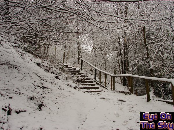
This gave much heavier and more widespread snow across southern Britain,
particularly across parts of northeast Wales and the west Midlands.
We travelled up to north Wales as the snow was falling, and enjoyed
a winter wonderland into the 10th February. The next three photos
show some of the scenes from this snowfall event in north Wales. More
images from this snowfall can be found here.
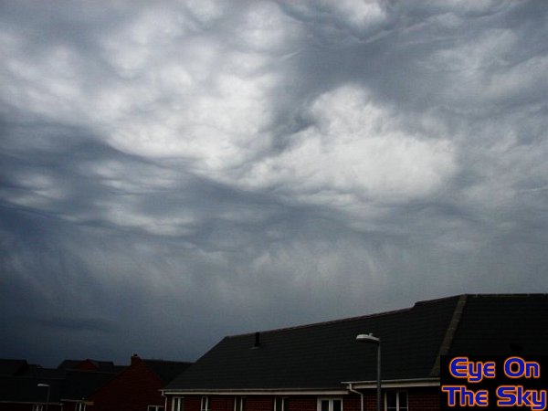
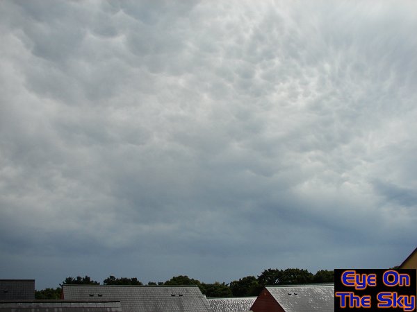
The remainder of February was generally milder and more unsettled,
with some heavy showers around. One particularly heavy shower gave
some stunning mammatus across Weybridge later in the month, as shown
in the final image.
March
2007- Delight
after deulge!
March started off on a very unsettled
note, as a series of depressions brought almost daily rain. Some of
the showers were really rather potent, such as the storm in the first
photograph below, which gave hail as well as torrential rain. The
result of this was river flooding, even in the tradionally drier southeast.
The second photo below shows the resulting flood on the Wey Navigation
in Surrey, as water poured over the banks into surrounding fields.
Into the second week of March, high pressure took hold, settling conditions
down. There was plenty of sunshine by day and clear skies by night.
The third photo shows a glorious day in south Devon, whilst the fourth
photo shows a spectacular lunar eclipse, viewed from Surrey, thanks
to clear skies. The settled weather lasted for about a week, but was
swifty followed by more downpours. The fifth photograph below shows
a particularly nasty thunderstorm in Weybridge on 19th, which looked
like an atomic bomb! Finally, we completed March by characteristically
chasing the Severn Bore for the only time in 2007.

April 2007 - Summer
comes early
The spring month of April was very much
summerlike in 2007, and broke records in terms of dry and warm conditions.
It was definitely a month to be enjoyed outdoors, and the EOTS team
spent their time in both Surrey and Devon. The first image below shows
a typical evening scene, with sunset casting crepuscular rays over
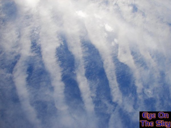
the Thames in Surrey. Conditions later in the month became ever more
summery, as warm, humid air resulted in mid level cloud formations
typical of warm, Spanish plume scenarios. The second image below shows
some mid-level altocumulus as temperatures nipped into the low twenties
Celsius, whilst the third image shows altocumulus castellanus, sometimes
the signal for thunderstorms but not in this case.
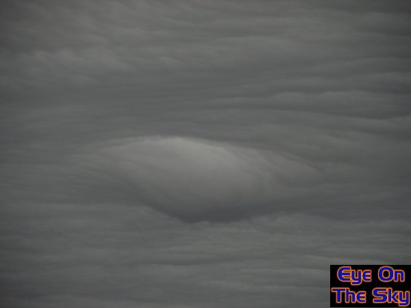
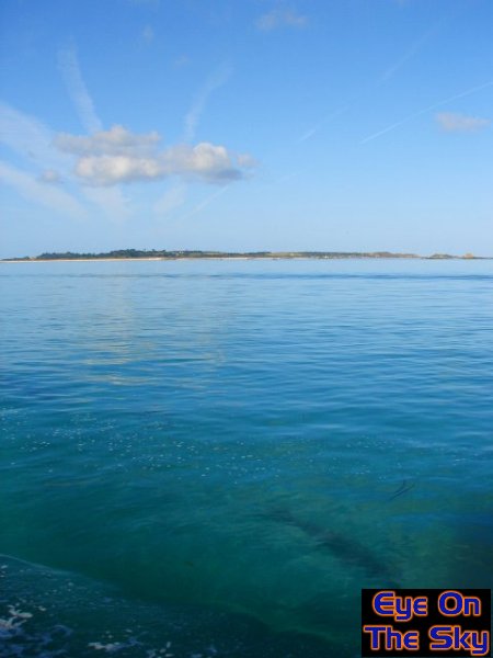
May 2007 - A
month of contrast
April's settled conditions continued
into the first few days of May before things began to go downhill.
Whilst in Devon, approaching fronts on the 6th interacted with the
high ground of Dartmoor to give impressive standing waves and undulations
in the cloud over Exeter. Photograph one below shows one such undulation
which remained stationary for some time. Rain or showers then set
in for a couple of weeks, particularly across the south. Photograph
two shows a nearby rainbow during a heavy shower in north Wales
on the 12th May. It wasn't all doom and gloom though, as another
settled period in the south during the third week allowed temperatures
to increase markedly. The third photo below shows a gloriously sunny
day over the Wey Navigation, near Guildford in Surrey. Some excessively
wet and windy weather hit the UK at the end of the month, but due
to work commitments, the EOTS team were not able to document this.
June 2007 - Lots
of weather - sadly missed!
June was a memorable month for many parts
of the country, as the UK weather was dominated by cyclonic and potentially
destructive conditions. The first major flooding event of the summer
affected parts of northern England and the Midlands, whilst tucked
in Devon for June and stuck in work, the EOTS team weren't able to
document anything. The photos for June all come from just one day
- the 19th. Warm and humid air began to pulse towards the UK from
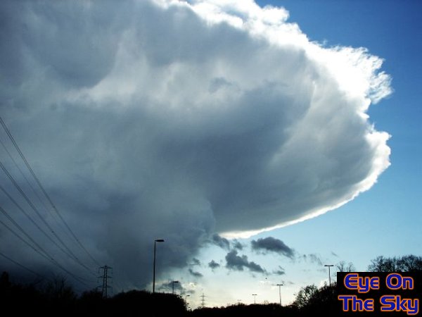
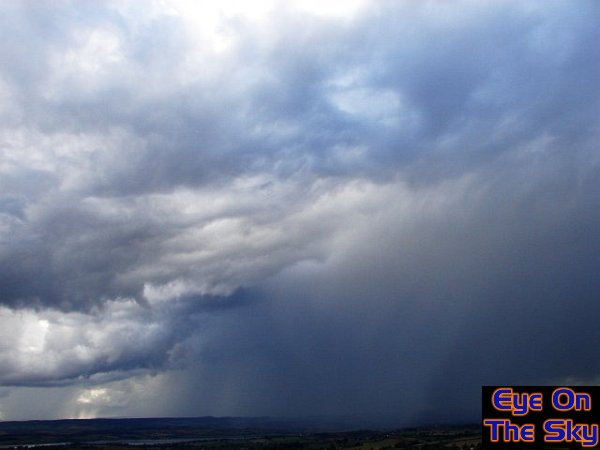
France, and brought with it some nasty thunderstorms. Once such storm
hit Exeter during the afternoon of the 19th, and the photos below
show its arrival. Firstly, altocumulus and cirrus increased, giving
some optical phenomenon. Then, an amazing shelf cloud approached ahead
of the thunderstorm. Lastly, the immense downdraft of torrential rain
can be seen as a wall in the distance, as thunderclouds boiled overhead.
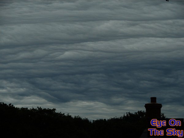
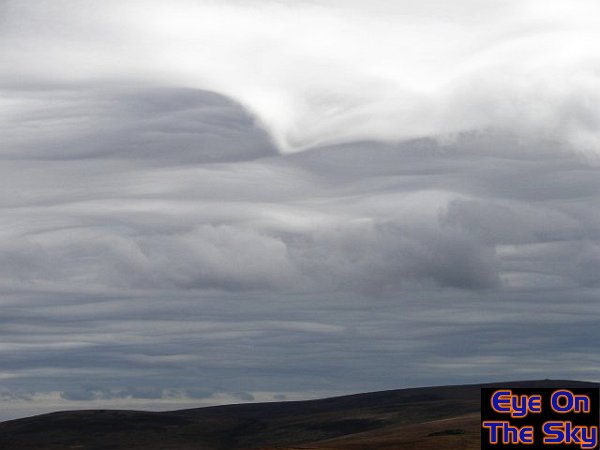
July 2007- Impressive
clouds but we escaped the deluge!
July could be classed in much the same way as
June - unsettled. There were plenty of showers and thunderstorms across
the UK, not least the storms and torrential rain that brought some
of the worst flooding in generations across the Midlands and central
southern England. Earlier in the month, however, a downpour gave some
impressive cloud structure as it moved away from Exeter. The first
photograph below shows well-defined mammatus formations lowering from
the anvil of the departing storm. Conditions settled quite quickly
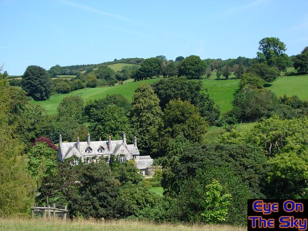
into the second week of July, and Devon in particular enjoyed some
warm, sunny days. The second photo below was taken on the Southwest
Coast Path near Dartmouth, showing the lovely sunny scenery. Around
mid-month, warm and humid air returned to the UK, giving the torrential
rain across central England. One noteworthy weather front gave quite
spectacular cloudscapes across Devon, as the low-level winds once
again interacted with Dartmoor to give undulations and swirls in the
cloud bases, which actually made the local news. Photographs three
and four below show just how intricate and spectacular these cloud
structures were. Towards the end of the month, a cold front swept
eastwards and revealled the most remarkable mammatus clouds on its
rear edge as it moved away. The clearance was stunning and abrupt,
and is shown in the last two photographs below.
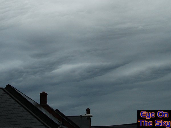
August
2007 - A
bit of everything - even some summer weather!
In the first week of August, there was a lot of
dry weather across Devon, but weak fronts occasionally affected the
southwest. One such front, on its approach, created some spectacular
Kelvin Helmholtz waves above Exeter. These were, in fact, pretty much
text book in appearance, as can be seen in the first image below. At
the same time, other undulating waves were filling the sky, as can be
seen in the second image below. Into the second week, and conditions
became more lively, with showers and thunderstorms across south Devon.
The third and fourth images below show one such line of thunderstorms
which developed along a convergence line in south Devon. During the
third week of the month, there were plenty of settled days once again
with decent warm sunshine, as can be seen in the fifth photograph below
which was taken near Moretonhampstead, Devon. Right at the end of the
month, conditions were still settled, and the Dartmouth Regatta benefitted.
In the final image, the Red Arrows are doing their stuff over the Regatta
crowds.
September
2007 - A
late summer
High pressure lay close to the UK throughout
the first half of September, and it couldn't have come at a better
time for the EOTS team, who spent the first week of the month camping
on the Isles of Scilly. There were a few breaks in the fine, sunny
weather whilst on the islands but things could have been much worse.
The first image below shows a typical calm sunny day on the water
between islands, whilst the second image shows one of the many beautiful
sunsets we captured on the islands. It became more changeable mid-month
with frontal systems affecting the south-west. In true fashion, the
affects of Dartmoor on the clouds above didn't disappoint, creating
some wonderful wave patterns, as seen in the third image. Towards
the end of the month, there were more crystal clear, sunny days in
south Devon, which we enjoy by getting in plenty of coastal walking.
Despite the warm sunshine, as the last image below shows, autumn was
hinting at making an appearance as the evenings became rather misty.
October
2007 - A
high pressure month!
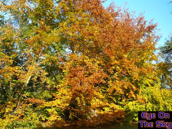
After a very dry September, October would
see little change in the overall weather type as high pressure dominated
conditions across the UK. The combination of a very wet summer and a
very dry autumn, appeared to be just what the UK's trees needed in order
to put on a full show of autumn colour. Some of the most spectacular
oranges and reds seen for years filled the countryside, as shown on
the first image below, taken in the EOTS team's new home of Leatherhead,
Surrey. As the fine weather continued, lots of country walking was the
best use of time, such as in the second image below which was taken
in the South Downs in Surrey.

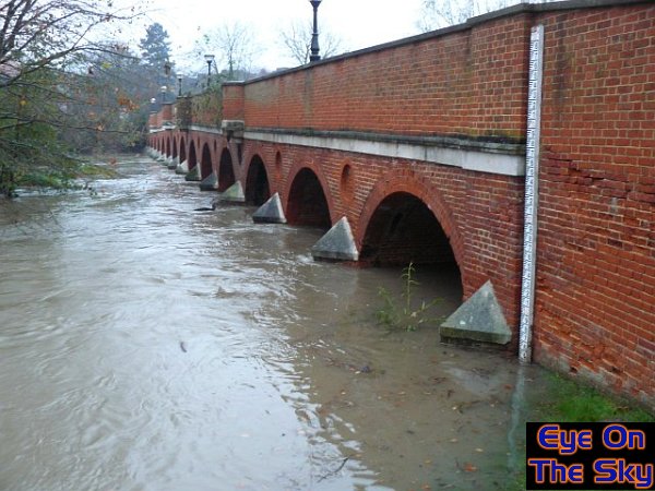
November 2007 - Wet
wet wet!
As if to make up for the dry autumn so far, low
pressure began to dominate the UK's weather during November, bringing
with it wind and rain. It was a surprisingly thundery period in parts
of the south, with thunder heard in Leatherhead, Surrey, on three consecutive
days. During this mid-month period, over 70mm of rain fell in the North
Downs over four days and this allowed the River Mole at Leatherhead
to burst its banks, as shown in the first two photographs below.
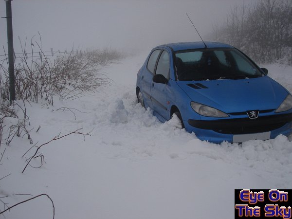
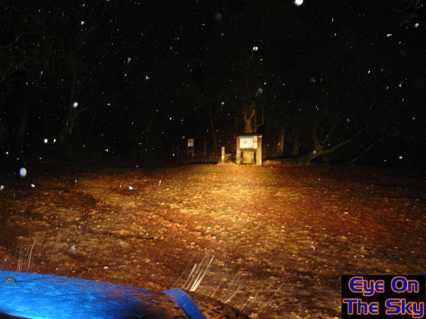
As an area of low pressure tracked across the UK on the 18th, rain became
sufficiently heavy to cool the air and allow snow to fall. This settled
quite widely in the Midlands, and even south of London snow was falling.
The third image below was taken on Leith Hill showing wet snow. That's
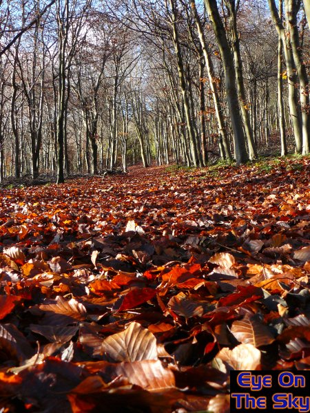
not to say there weren't any fine days in November, as the last photo
in the sequence shows. A bed of autumn leaves line footpaths through
Norbury Park near Leatherhead, on a sunny and calm day in late November.
December 2007 - The
anticyclone
The month began much as November, with low pressure
resulting in strong winds and outbreaks of rain. However, during the
second week, high pressure over Scandinavia began building westwards
across the North Sea, and this would come to dominate the UK's weather
for some time. Clear, sunny skies interspersed with numerous banks
of low cloud moving in from the continent resulted in alternate frosty
and frost-free nights, with mist and fog becoming more widespread
as time went on. Daytime temperatures struggled to rise whilst subzero
overnight temperatures were realised for almost 14 consecutive nights
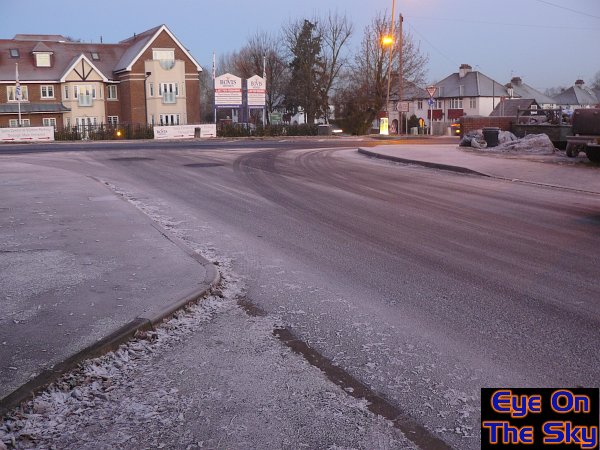
in parts of the south and east. The first two photographs below show
the frosty conditions in Leatherhead, with the first showing a mixture
of frost and rime from freezing fog, and the second showing how frost
accumulated on untreated roads. On the continent, conditions were
much the same but even colder. The third photo shows our trip to Brussels'
Christmas market, where despite sunny skies, temperatures held below
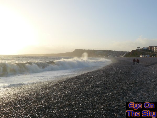
freezing. Further west in Devon, frost was less severe but the sunny
skies were just as welcome, as seen in Budleigh Salterton. Note that,
despite the high pressure conditions, swell waves from the Atlantic
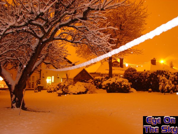
were still impressive. Milder conditions returned in time for Christmas,
resulting in a green festive holiday just about everywhere.


Will
2008 be a weather year to beat 2007? Here's hoping......

Copyright
eye on the sky 2001-2008
|