
|
>Chase
> Click on the images to view chase accounts. |
|
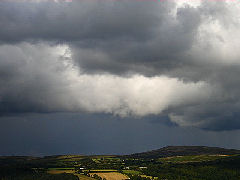
| FILKINS
TORNADO & SUPERCELL- March 2004 Way back in 2004, the EOTS team went storm chasing in central-southern England. It was only March, so they were not expecting to see anything particularly severe. Little did they know that not only would they stumble across a thunderstorm with severity to rival any summer storm, they would also uncover a potential supercell thunder-storm, and would come within a couple of miles of a damaging tornado. Account opens in new page. |
 |
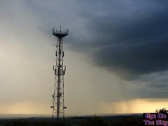
| HIGH
PRESSURE THUNDERSTORM - June 2006 At the start of June, high pressure dominated the scene across the UK. However, this did not prevent a scattering of showers and thunderstorms developing, as an upper trough drifted past. We intercepted one such storm in Wiltshire which, whilst not particularly active, gave some quite spectacular cloud scenes. The report includes photographs and video of the event. |
 |
| CHASE
FLORIDA - July 2006 The EOTS team's very first overseas storm chase took them to Florida, in the south-east United States. The state is famous for its afternoon thunderstorms and waterspouts, and the EOTS team wanted a piece of the action. We witnessed violent thunderstorms, lightning strikes mere metres away, flooding and torrential rain, and even a couple of waterspouts. This chase account opens in a new mini-site, dedicated to our trip. |
 |
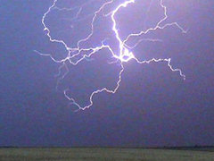
| CAMBRIDGESHIRE
DESTROYER - July 2006 On 26th July, after days of very warm and sunny weather, a slack area of low pressure became stagnant over the UK. With humidity and instability building, it was only a matter of time before everything went BANG in a big way. We headed on a storm chase to East Anglia in order to prepare for the afternoon and evening's superb storm display. |
 |
| WEYBRIDGE
THUNDERSTORM - July 2006 On 27th July, a warm and sunny day ended across Weybridge, Surrey, with the arrival of a powerful thunderstorm. The storm continually renewed itself over the same spot, lasting for well over and hour and dumping constant, torrential rain. This report documents the event and includes satellite and radar imagery, photographs and video. |
|
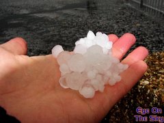
| WEYBRIDGE
HAIL STORM - November 2006 On 26th November, a violent thunderstorm ripped across Weybridge and the surrounding area. As well as torrential rain and frequent lightning, the storm was a prolific hail-producer. Hail fell to depths of up to six inches in places, and the hailstones were large enough to produce damage to car bodywork. The EOTS team didn't have to travel far to witness this storm, but it was the most personally damaging storm we've witnessed. |
 |
| DEVERGENCE
- August 2007 The interaction between the sea breeze and the topography of South Devon created a superb convergence line on 6th August 2007. This line produced a strip of heavy showers and even thunderstorms during the afternoon and evening. This report covers the relatively short EOTS team chase across South Devon, in which we viewed the line both from the south and the north. This was a benign storm chase but with some decent clouds. |
 |
| CHASE
FLORIDA - June/July 2008 The EOTS team headed out to the Sunshine State once again to take on the daily tropical downpours and thunderstorms which hammer Florida almost every afternoon during the summer months. After covering thousands of miles, we bagged plenty of active thunderstorm footage which can all be found in our 2008 Chase Blog. There were no tornadoes this time but damaging winds, lethal lightning, hail, flooding rains and awesome cloud structures more than made up for this. |
 |
|
eye on the sky 2001-2009 |
|