November 2006 was dominated by warm south or south-westerly winds, and
very unsettled weather conditions. On 25th November, a vigorous cold
front crossed the UK, becoming slow-moving across the south-east of
England overnight. During the 26th, this cold front boundary became
stationary in a line from the Isle of Wight to the Wash. During the
day, an area of instability in the upper air engaged the cold front,
exploding it back to life. The result was spectacular, with violent
thunderstorms and torrential rain in a very narrow line stretching from
south-west to north-east. This line sat just to the west of Weybridge,
Surrey, throughout the morning and early afternoon. However, between
10am and 11am, a ripple ran northwards along this line of storms, which
would deliver Weybridge and surrounding area with an epic thunderstorm
and near-severe hail.
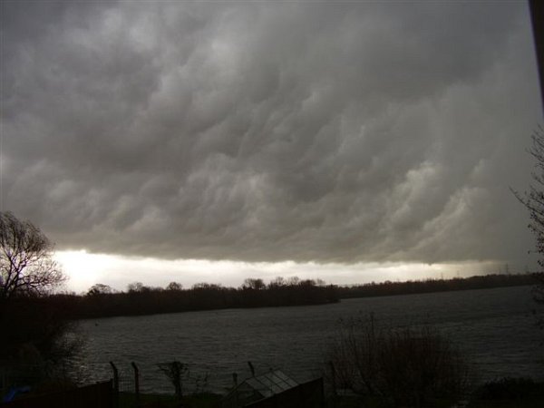
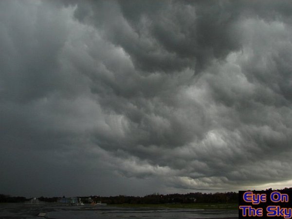
During
the morning, thunderstorms sat just a mile or so to the west of Weybridge.
Here, the morning sunshine lights up the dark clouds.
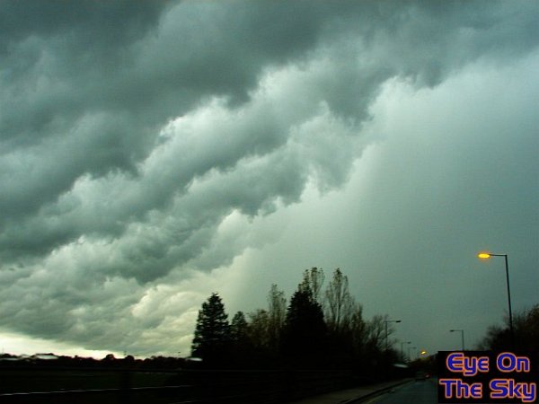
Heading
down towards Brooklands at around 10am, this monster gust-front raked
across the southern sky, with the solid downdraft of precipitation following
behind.
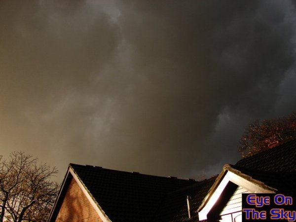
As
lightning forked its way across the sky, daytime darkness began to set
in. Here, the huge downdraft was just half a mile away, and thunder
was booming all around.
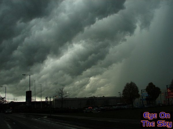
Bren
was now directly beneath the ragged gustfront clouds on the leading
edge of the thunderstorm. It was now only a matter of time before it
poured down!
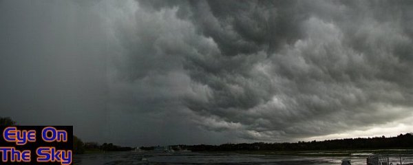
A
panoramic image looking north-east, as the thunderstorm continued to
roll overhead.

Hailstones
began clattering down amongst the torrential rain. At the time of this
photograph, most of the hailstones were around pea-sized.

As
I sat in my car, the hail suddenly became much larger. The thudding
on the roof was so loud, I decided to catch a hailstone, which was around
2cm in diameter.

Once
the hail stopped, I was able to step outside and have a look. Here,
the smaller white hailstones were pea-sized. The larger, opaque stones
were up to 25mm across.
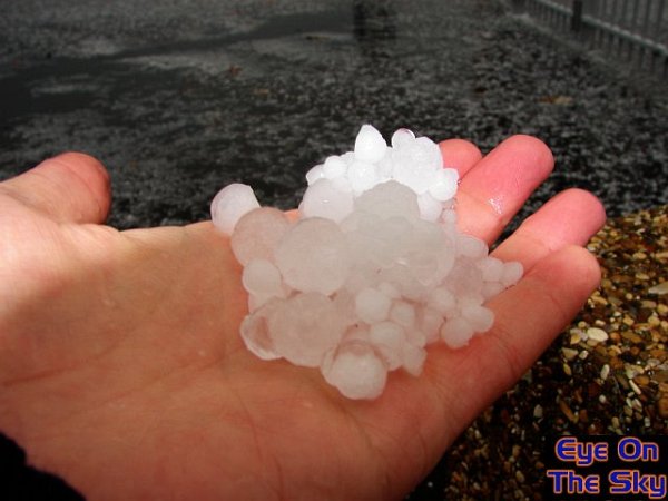 A
handful of hail. The largest stone, just left of centre in this clump,
was
A
handful of hail. The largest stone, just left of centre in this clump,
was
around 27mm in diameter, and was extremely solid in composition.

Swings
over Brooklands park, as the storm clouds boiled overhead.

The thunderstorm left behind travel chaos, with huge floods across the
town.
Roads were left covered in marble hail, proving rather slippery.

A local supermarket carpark was covered almost side to side by a few
inches of floodwater. The hailstones bobbed around in the water, washing
into drifts.
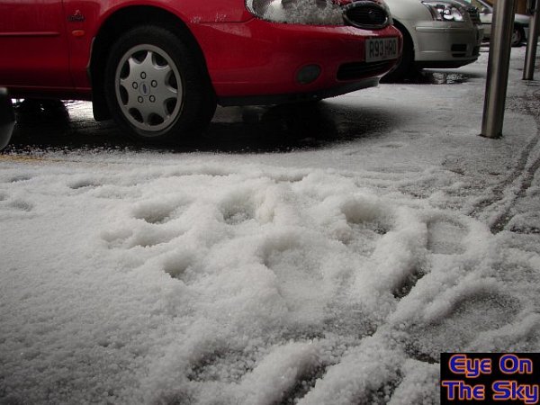
A
winter-like scene, as hail lay in drifts up to six inches deep. Shoppers
who went into the supermarket in sunshine, couldn't believe their eyes
when they stepped outside!
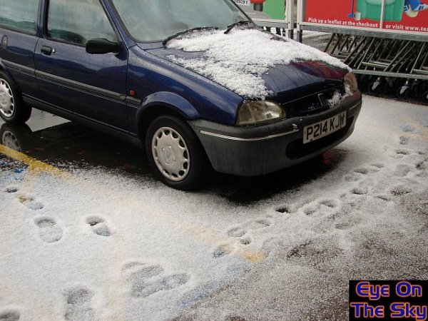
Another
image of the hail-covered cars and carpark.

Roads
were covered in hail up to an hour after the hailstorm....
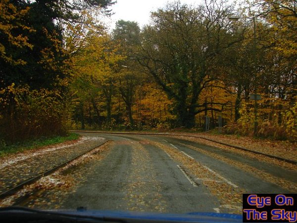
....and
if hail wasn't covering the road surface, then leaves, stripped
from the trees by the fall of hail, were just as slippery!

The torrential rain left ponds of water everywhere!

The
storm-chasing Stilo sitting on the hail covered tarmac as
the storm clouds slowly moved away into the distance.

The
dirty bodywork of the car was stripped clean by the hailstones.

Little
did I know that the hailstones were more damaging than I imagined. The
Stilo was marked by small paint chips following the storm, and there
were a number of small dents in the bodywork, after hail-impact. Here
are just a selection.
The
following images were sent in to us by Dave Chittenden, who watched
the thunderstorm rolling northwards from Shepperton. The village is
only a mile or so north of Weybridge, and the impending scene was very
similar.