We had recently returned from our storm chasing trip to Florida, and
one would think we'd had our fill of thunderstorms for the year. However,
you can never see too many storms! On 26th July 2006, a very slack area
of low pressure sat over the UK, drawing in very warm, very unstable
air from the south. After a few days of warm, sunny weather, things
looked set to go bang in a big way. We decided that a focal point for
thunderstorm activity would be across East Anglia during the afternoon
and evening. The EOTS team met up with Matthew Dobson, a colleague and
fellow storm chaser, and made the trip northwards in search of storms.

The
midnight synoptic chart from the UK
Met Office on 27/06/06 (copyright
wetterzentrale).
A slack area of low pressure and associated trough remain close to East
Anglia after a day of thunderstorms along the eastern side of England.
We
spent much of the afternoon peering at hazy blue skies from the baking
tarmac of a service station. It was so hot that our map, left in the
car, melted! Despite the heat, there was a strong and gusty wind which
regularly kicked up dust devils.

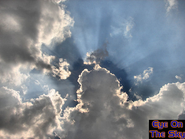
Right
at the end of the afternoon, almost from nothing, towering cumulus clouds
began erupting. The humidity in the upper atmosphere was obvious from
the sun's rays.
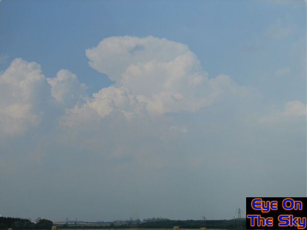
As
the clouds began to grow, it was obvious that it wouldn't be long before
these developed into thunderstorms. We hit the road in search of storms.
..and
here was the first storm of the day. It was too far north for us to
chase, on the southern edge of the Wash. Reports suggested large hail
from this storm..
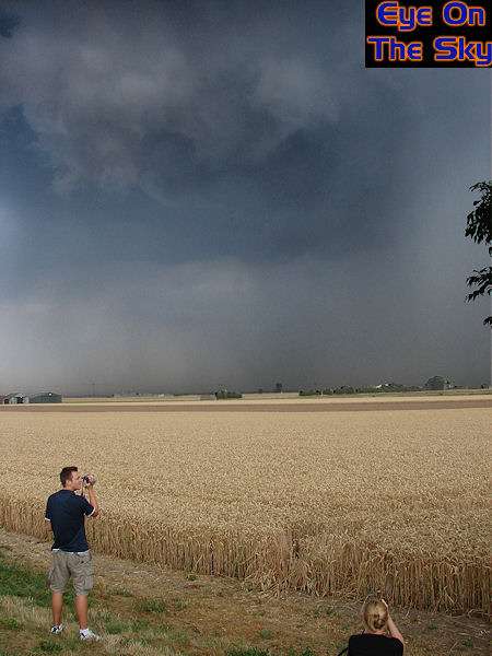
We
parked up just ahead of the storm and watched it roll in. Here, Matt
and Laura struggle to hold their cameras still as outflow winds battered
the area.
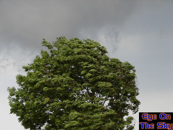
This
tree is being battered by 30mph straight-line winds.

As
the first storm caught up with us and began to weaken, we headed southwards
towards new developments on the Norfolk-Cambridgeshire border.
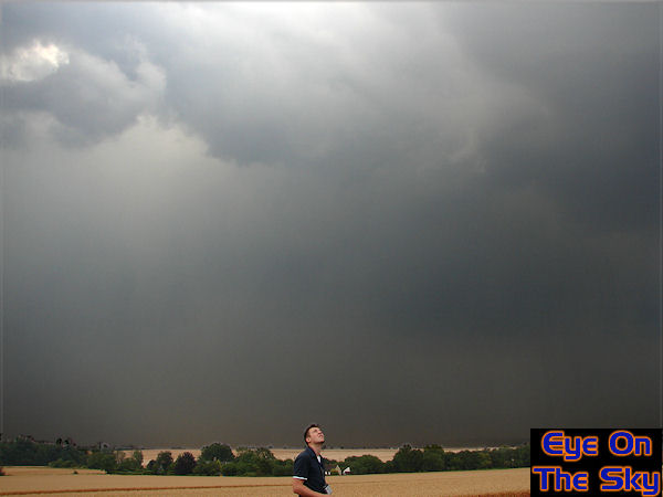 After
heading southwards into mid Cambridgeshire, we headed back eastwards
off the A1 to intercept newly firing storms lining up from west London
north-eastwards. Matt inspects new developments overhead.
After
heading southwards into mid Cambridgeshire, we headed back eastwards
off the A1 to intercept newly firing storms lining up from west London
north-eastwards. Matt inspects new developments overhead.
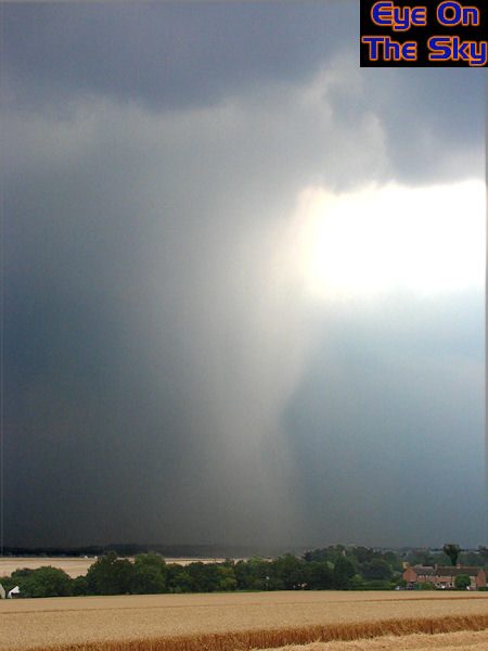
The
storm just to our east fired out a wet microburst, unleashing vast quantities
of water on the Cambridgeshire landscape.
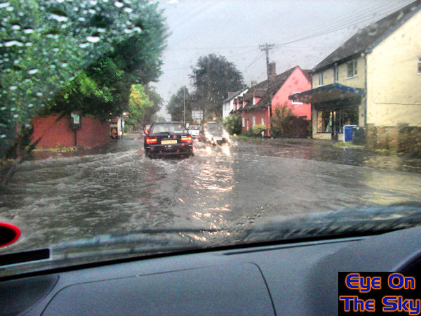
Once the downpour moved on, we headed east to where it had fallen. Our
journey took us through Royston which was partially under water. We
picked our way carefully.
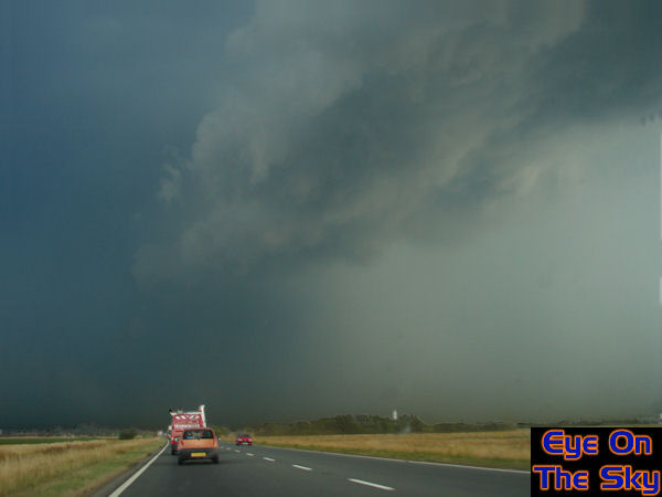
We
then hit another fresh downburst head-on. As well as torrential rain,
we encountered quite large hail which made quite a noise on the car
roof. Towards the front edge of the thunderstorm, we were hit side-on
by an epic straight line wind which must have been reaching in excess
of 50mph. Whilst we have no photographs of this part of the journey,
our video cameras were rolling. To view the video, visit our video section
or see below.
Video
details:
Format: Windows
Media Video (wmv)
Video: 22.2mb,
2:08
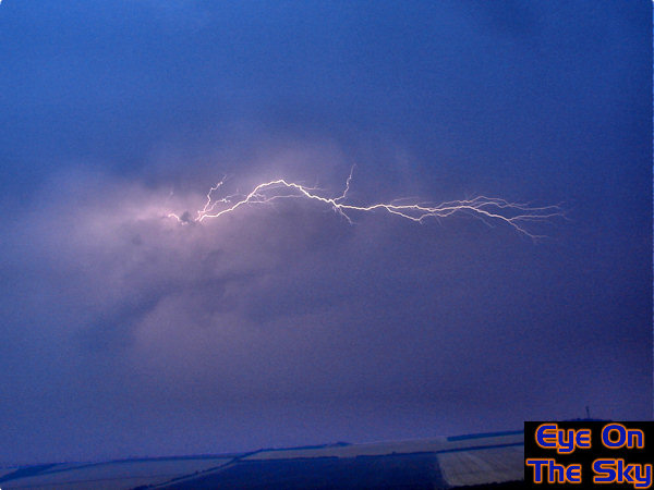
Once we were out of the storm, we settled on a small hill in east Cambridgeshire
and prepared ourselves for an evening light show. The storm was kicking
out regular CC and CG lightning strikes, such as this here.
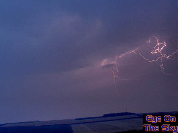
More
lightning from the storm.
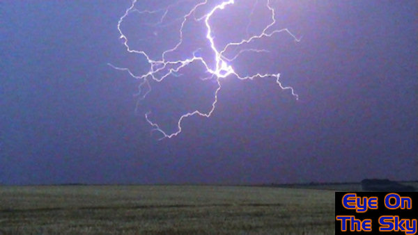
A
video grab from one particular lightning bolt reveals this curious spider-like
shape which, when viewed frame by frame, appeared to 'wheel' around
until the final channel was picked and discharged.
Despite
a fantastic fortnight of storms in Florida, this storm chase across
the UK more than met our expectations. With a combination of great cloud
structure, torrential rain, large hail, damaging winds and vivid lightning,
this storm chase ticked just about every box and will go down as one
of our most memorable in the UK.