Event 2 -
Warm Front Whiteout!
-
11th/12th March 2006
On the evening of the 11th March, after over a week of cold weather,
a very active warm front attempted to bring in milder air off the Atlantic.
However, this warm front had a titanic struggle, with deep-seated cold
air proving very difficult to shift. In fact, the warm front did not
succeed, and after spending many hours draped across Wales, northern
England and Scotland, it died out, leaving behind the cold air. Snowfall
was the result, and lots of it. Prime location was central and southern
Scotland, where over a foot of snow fell during the night of the 11th,
and into the morning of the 12th. However, parts of north-west England
were hit, and in particular, north-east Wales also took a pasting. Here
is the midnight chart on the 11th March, going into the morning of the
12th, courtesy of the UK
Met Office:

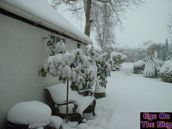
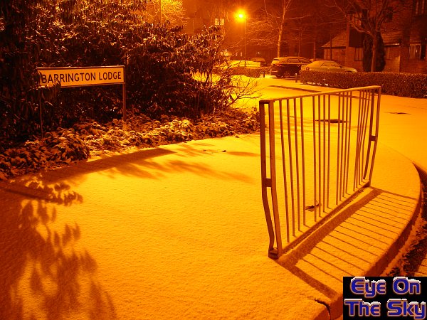
Snow
began to fall in north-east Wales at around 20:00 on the 11th, and continued
until midday on the 12th. Although the snow was never particularly heavy,
it fell steadily for this long duration. The result, was between 5 and
6 inches of level snowfall, which brought much of north-east Wales to
a standstill. Roads were suitably gritted, but the relentless fall of
snow quickly overpowered this. The following set of images were all
taken on the morning of the 12th, by Bryn Jones.

At
around 08:00, the snow continues to fall across north-east Wales,
measuring accumulations of up to 4 inches at this time.

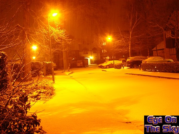
Another
view of the snowy landscape during the morning of the 12th March.
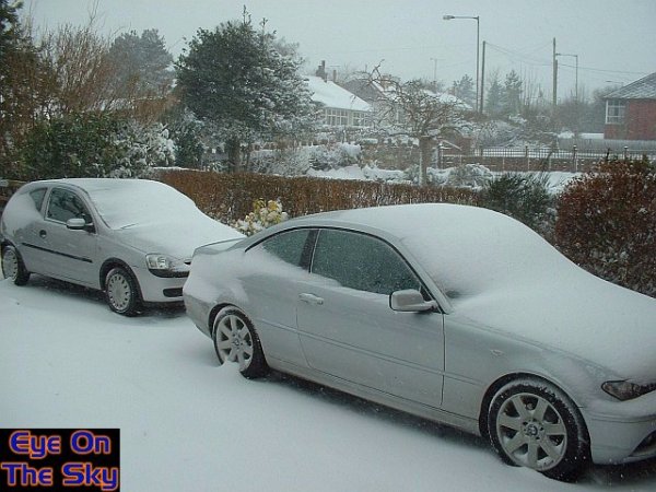
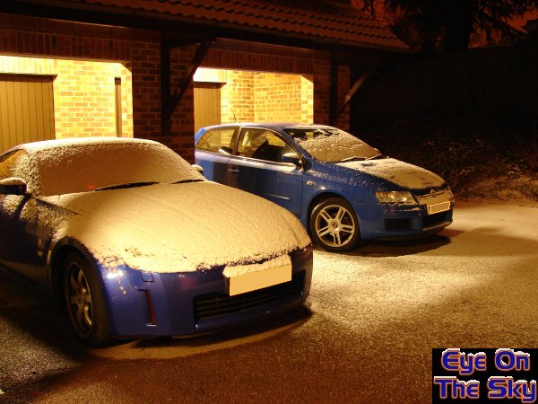
Strong
winds allowed the snow to drift, forming curious bulges on the sides
of cars. The
last time I witnessed the drift surrounding the driveway gate, was back
in 1996!

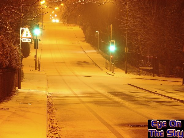
By
10:00, snow had accumulated to 5 inches, and more on some surfaces.
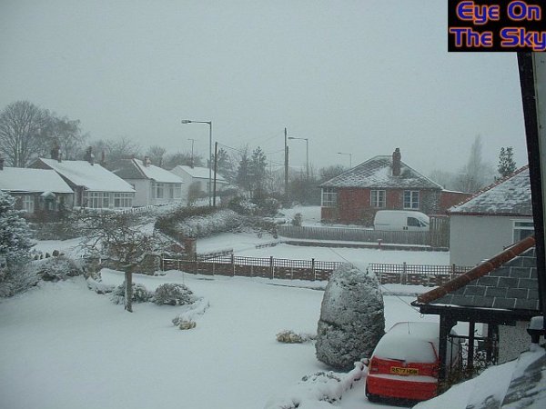
The
drifting nature of the snow can be seen on the roofs of houses. The
south facing roofs here are snow free, whilst the east facing sides
have collected plenty of the white stuff.
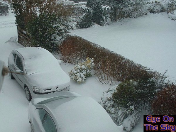
Similarly
to the roofs on houses, south-facing sides of cars remain snow-free,
whilst
east and north-facing sides bulge with snow.
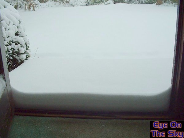
Opening
the front door of the house revealed a 5 inch drift, on top of the 5
inches of level cover. In fact, the drift was deeper than this, but
the top has been snapped off,
sticking to the outside of the door (far left).
Close
to midday, and the snow begins to ease off. Six inches of
level snow now blanket north-east Wales.

The
snow eventually dies out, leaving behind one of the
heaviest snowfalls in the area for a number of years.
The
100 hour fog
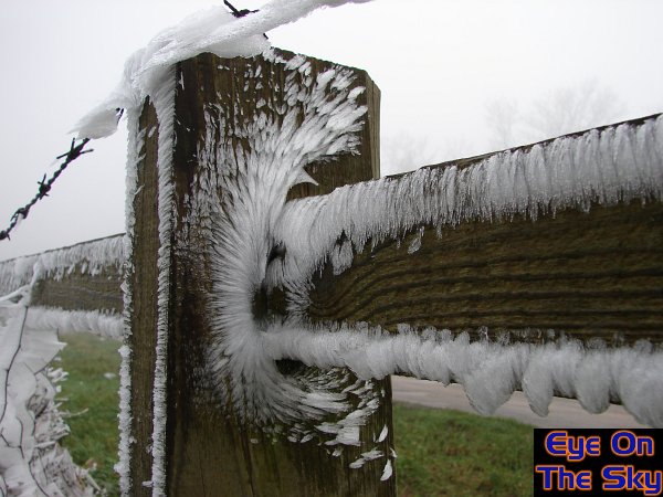
In
December 2006, high pressure allowed fog to set in across south-east
England which lasted unbroken for 100 hours. On higher ground, this
fog became freezing and deposited amazing rime formations, such as those
seen above. For a detailed report, numerous images and videos of this
event, please see the
100hr fog in our events section.
>Snow visits south-east
England....twice!
Up
until late-January 2007, the winter of '06/'07 had been astonishingly
mild. Records had tumbled during the previous two months, and any
thought of cold and snowy conditions were merely a pipedream. However,
all that was to change on one night in late-January, and another in
early-February, when lowland areas of southern Britain were to receive
some of their most widespread snowfall in years.
January
24th 2006
One of the first true northerlies of
the winter had established during the 22nd of January, bringing in
colder Arctic air. Wintry showers affected Scotland and north-east
England, but with little else at this stage. However, during the early
hours of the 24th, a small low headed southwards across the UK. The
triple point of this low (the point where the cold front, warm front
and occluded front meet) travelled directly through the Midlands and
southwards through central-southern England. To the west of this triple
point, snow fell for a while before turning to rain. To the east of
this triple point, snow fell and remained as snow.
Below
is the synoptic chart from the UK
Met Office,
which shows the position of the triple point heading southwards at
midnight, thanks to Wetterzentrale:

Over-excited
by the first snowfall of the season, the EOTS team stayed awake into
the early hours in anticipation of its arrival. It took its time however,
so several power-naps later, the snow arrived at around 4:30am. The
following series of photographs were taken from 4:30am onwards around
Weybridge, Surrey. The aim was to capture the crisp blanket of snow
before rush-hour traffic and commuting had chance to ruin it.
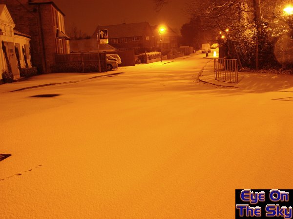
Just
after 04:30am, and the snow had been falling for about 20 minutes.
Landing on a frozen ground, it was able to accumulate nicely on all
surfaces.
It
was very dry, powedery snow for a while, but with little wind to speak
of it lay evenly across the roads and pavements.
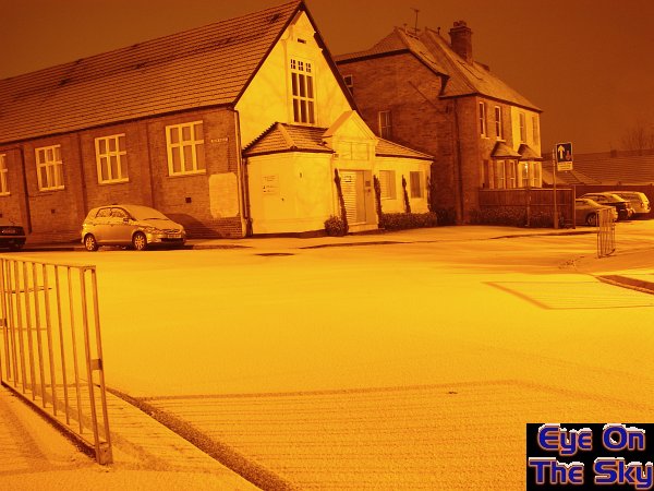
The
orange glow of streetlights made for lovely shadows on the lying snow.
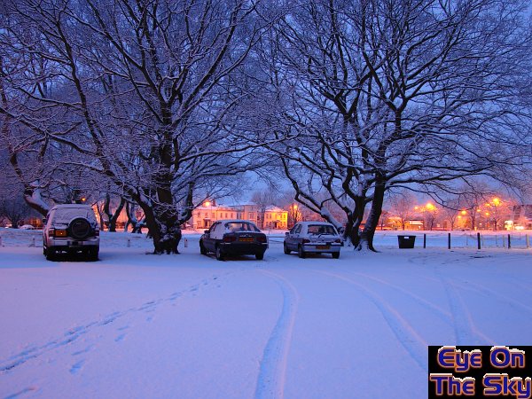
The
main road through Weybridge with only one car having passed so far
(and another coming). Snowy roads are dangerous, but far prettier
than slushy car-ruined scenes.
By 5am the snow was still falling, and the light blanket was gradually
becoming thicker.
The EOTS Stilo was dying to get out into the morning snow!
After
another power-nap, it was time to get up at dawn. Snow was still falling
lightly, and by this point there was around 2-3cm of accumulation.
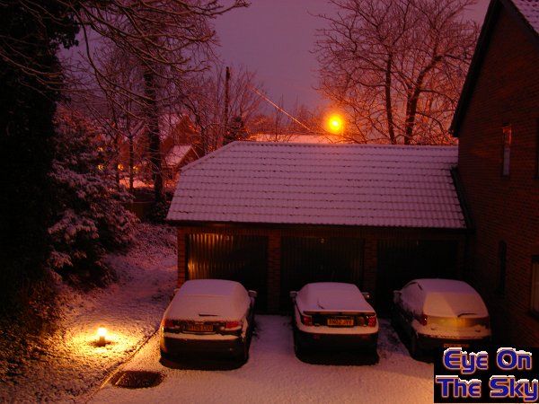
The dawn filled the scene with a pink-purple colouring.
As
dawn breaks, the coating of snow just looks beautiful under the increasingly
purple-pink skies. Weybridge cricket green was very definitely not
green!
By
mid-morning, the snow had ceased, leaving grey and overcast skies.
By early afternoon, we headed south to the North Downs of Surrey.
In particular, we headed up Leith Hill, which at just under 300m is
the highest point on the North Downs. At the bottom of the hill, snow
was patchy, but it soon increased on the way to the top.
We
filmed the drive from bottom to top and have put it together in a
timelapse movie. Please click the following link
to view the video, or visit our video
section for more details.
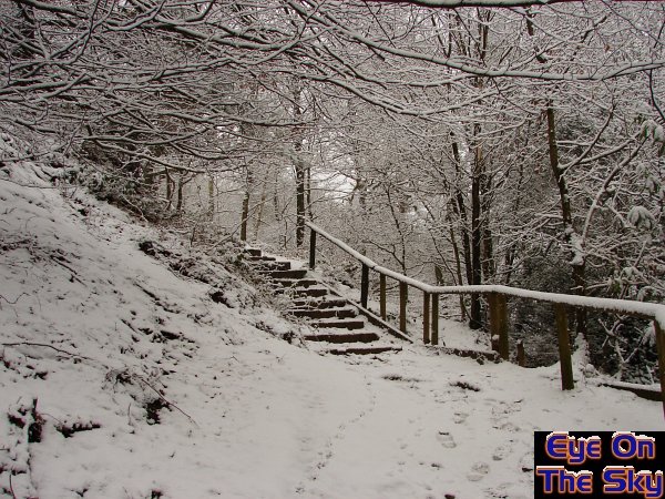
The
walk from the carpark of Leith Hill to the summit rose around 50 metres.
Snow depths were up to 5cm on Leith Hill, and it was a true winter
wonderland.
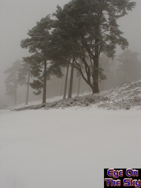
On
the summit, it was particularly windy, whipping the snow around.