|
|
|
31st May 2010 |
|
31/05 Day
15 The slight risk for today was largely to our west, so we left Garden City by late morning and headed westwards into south-east Colorado. Very early in the day, one small and discrete thunderstorm had already developed, several miles west of the town of Springfield. We therefore made the town our target and aimed to be arriving by lunchtime. The thunderstorm's anvil was clearly visible on our western skyline for the entire journey, and on arrival in Springfield, the impressively long anvil was sitting nicely overhead. Occasional thunder growled far above us in the anvil, and the odd cloud to ground lightning strike was observed. The storm was fairly weak at this stage and little else was happening, so we spent a short while enjoying a Subway Lunch at a service station in Springfield, with growling thunder overhead as a pleasant accompaniment. As the thunder grew more frequent and the echoes looked better on radar, we headed south-west of town to get ourselves a view of the thunderstorm's structure. It didn't take long before a nice wall cloud developed and this went on to produce a number of small funnel clouds. We decided to get closer to the action as we realied that the storm was almost anchored to the spot, and hadn't moved for a few hours. We headed west and found ourselves in Pritchett. By this time, rain and small hail were already falling over the town and a sheet of larger hail lay to our west. Convinced we'd trash our car if we headed further west, we retreated to the east of Pritchett once again to get a better view. Here, we saw an impressively large and rotating lowering which was reported by chasers as a tornado. However, marble sized hail was obscuring our view so we headed back east. We eventually found ourselves driving southwards from Springfield where we parked up to watch the storm to our west, now at sufficient distance to appreciate its structure. It morphed through several wall cloud phases with new updrafts and new hail cores coming and going. Despite the storm's base being many miles to our west, its anvil was streaming well over our heads and beyond the eastern horizon; this really was some impressively large supercell thunderstorm. Lightning seared from the anvil overhead, and one strike triggered a grass fire just to our north. Paul reported this on the Spotter Network and, after a short time, fire crews arrived to put out the flames. They cited a chaser report as the trigger for their action and thanked the chaser responsible - this was more than likely our report which alerted the emergency services, which we thought was cool! Whilst parked up here, we even had time to chat to a Colorado chaser we'd met almost a fortnight earlier! The storm now began to change form and became quite precipitation-dominated. We decided to keep ahead of the storm and parked up in Campo. However, it wasn't long before we were perilously close to the hail core so decided to keep moving. We eventually finished up just south of Campo on a dust road and were accompanied by a number of chasers. Here, we allowed the furiously rotating updraft base to roll over us, all the while keeping the precipitation core to our north and west. The odd large hailstone pounded the ground around us but, for the most part, we managed to avoid being hit. Whilst watching the manic cloud rotation above our head, a small dust whirl/devil pushed slowly through the gathered group of chasers, carrying some tumbleweed high above us. This seemed amusing at the time, but after what happened next, was perhaps a sobering event. As we began to take hits from golf ball hail, we were about to jump into the car. However, Matt pointed out a newly developing funnel almost overhead so we remained rooted to the spot. What happened next exceeded our storm chasing expectations and, possibly, the expectation of any storm chaser on any storm chase!! A huge, smooth, perfect funnel extended from the cloud base to the ground, touching the deck within half a mile of our viewpoint. Dust kicked up beneath the elephant trunk tornado, and its form was so perfectly solid it looked completely unreal. The form rapidly changed into more of a solid stovepipe shape and, for a time, the vortex actually drifted a little towards us, bringing its dust curtain with it. The wind blowing into the tornado was incredible, and seemed to pick up the very instant the tornado hit the ground. Despite being in complete amazement of what we were seeing, we had to move because golf ball to near cricket ball sized hailstones were now hitting (and denting) the car. One stone managed to clobber me on the head, drawing a little blood, before bouncing down onto my hip where it again gave a graze. With me at the wheel and Paul in the navigating spot, we joined several other chasers in what seemed like an incredibly scary move. We headed south straight towards where the tornado was about to cross the road. It was either this or a car destroyed by hail. We probably drove to within quarter of a mile of the huge, churning vortex to keep out of the hail's core, allowing the twister to cross the road so we could pile southwards behind it. Once south of the hail core, we pulled up and watched the amazing tornado slowly disappear behind a curtain of rainbow-graced hail. We weren't out of trouble here though and, whilst stood watching the tornado, the rear-flank downdraft screamed through us, giving winds probably exceeding 60mph and driving tumbleweed deep into the faces, arms and legs of the many chasers who were stopped with us. We continued to head southwards then eastwards into the evening hours, eventually losing sight of any more tornadic action but still being treated to some stunning thunderstorm structure. The storm took on a lovely mothership appearance west of Guymon, with yet more large hail and frequent lightning to keep us on our toes. We booked into our hotel in the city of Guymon but managed to arrive as our supercell thunderstorm also rolled into town. The centre of the city was pretty much under water, and as we attempted to pick our way through the flooded streets in order to find some food, we almost had to give up. We eventually arrived at the hotel after our McDonald's dinner, and all fell silent as the storm moved away. This was almost the perfect storm chase. We watched a single supercell thunderstorm for over ten hours, rapidly changing form but barely moving from where it first formed. We were treated to countless funnel clouds, close lightning strikes, huge hailstones, RFD winds and possibly one of the most visually stunning tornadoes ever seen. We were so lucky to have had the tornado form next to us, rather than actually having to chase it. On top of all this, it was our very last day of chasing before heading home. A day that will live with us forever. Total mileage: 297 miles |
 |
|
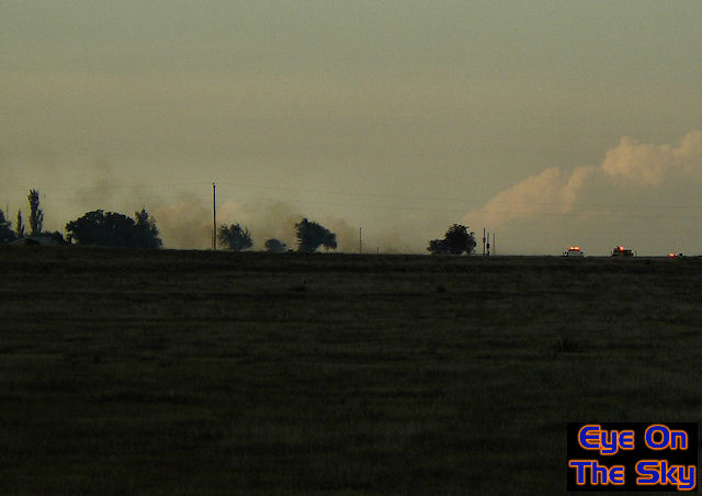
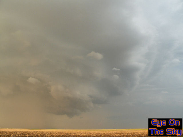
Heading westwards from Garden City towards Springfield, Colorado. This
relatively weak looking thunderstorm was our target, and was pretty much
the only thunderstorm in the Plains at this early stage. . |
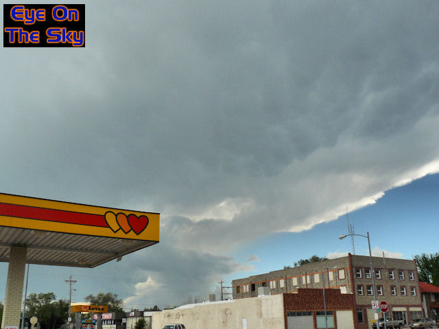 |
| We
arrived in Springfield by lunchtime, and the town was already nestled
nicely beneath the anvil of the nearby thunderstorm. Occasional thunder
grumbled overhead and lightning flickered. . |
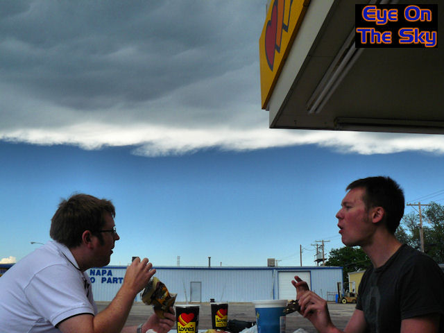 |
| We
felt so relaxed about the slow development of the thunderstorm, that we
found time to have lunch at Subway in the middle of town, as the anvil
thunder growled above our heads. . |
 |
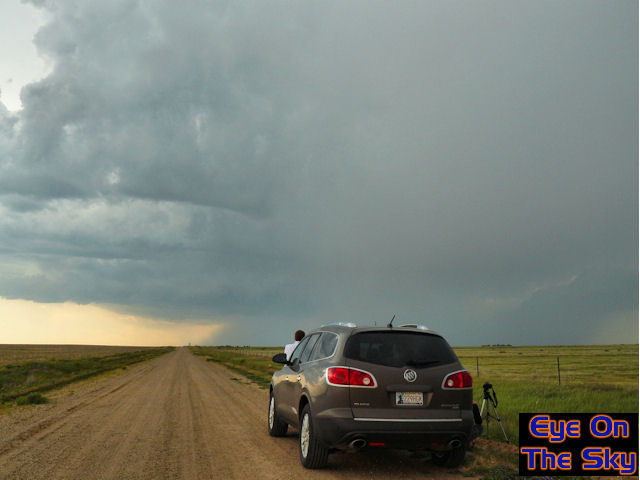
| After
lunch, we figured it was probably time to head out of town and get some
storm chasing started. We parked up several miles south of Springfield
to inspect the storm's base, a number of miles to our west. . |
 |
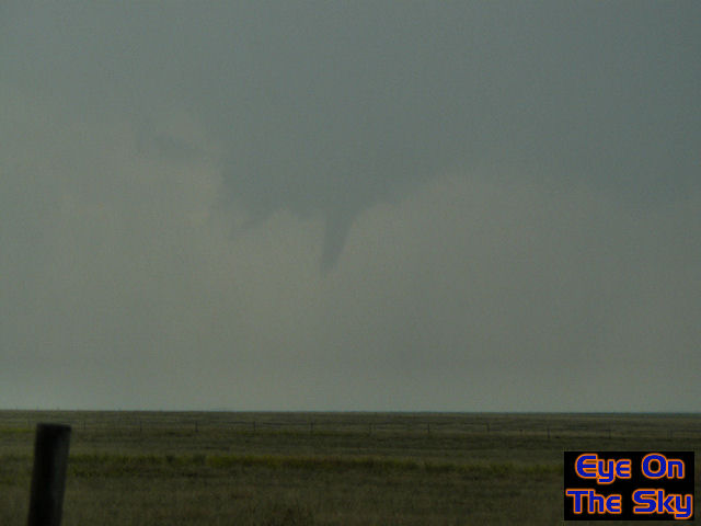
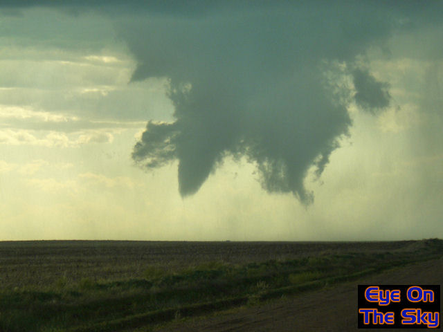
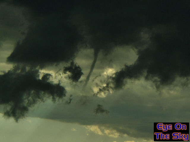
| The
storm quickly developed a nice wall cloud, and in no time at all, this
small funnel developed nicely beneath the wall cloud's base! . |
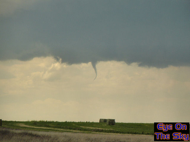 |
| Another
view of the small, curving funnel beneath the grumbling thunderstorm. . |
 |
|
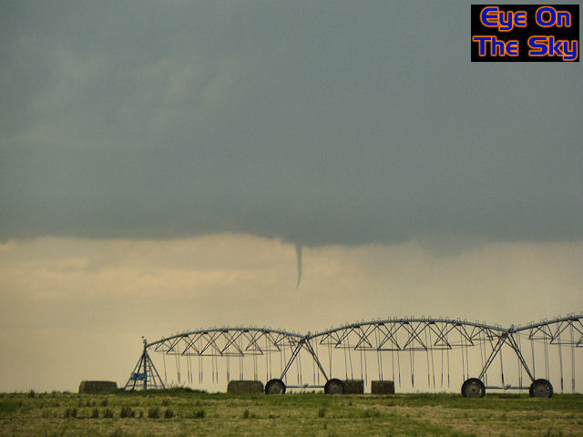
We then began to head
westwards towards the town of Pritchett. As we did so, another small
funnel protruded from the storm's base! |
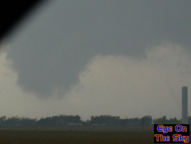 |
| Parked
up just east of Pritchett, this large rotating lowering grew steadily
towards the ground. It was masked by rain and hail before long, although
chasers closer to the action reported
a tornado. . |
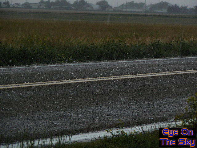 |
| As
we sat watching the potential tornadic developments just to our west,
it was clear we weren't going to be able to stay put as hail began lumping
down around us, generally up to marble size at this stage. . |
 |
| As
we retreated back eastwards again to get a wider view of the storm, it
produced yet another small funnel cloud, several miles to our west southwest. . |
 |
| Sat
south of Springfield and north of Campo. Here, we could observe the structure
of the storm morphing through numerous forms. Overhead, more anvil lightning
crackled away. . |
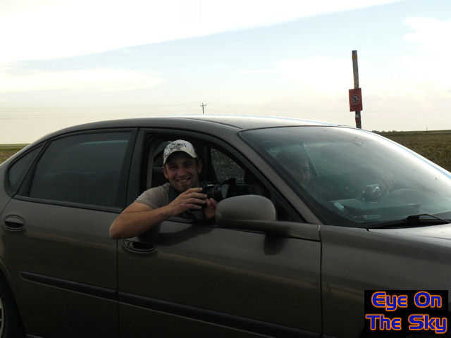 |
| By
chance, we bumped into Jason, a fellow storm chaser from Colorado, and
his friend. We first crossed paths on our first day of the trip up in
Limon, so it was good to catch up. . |
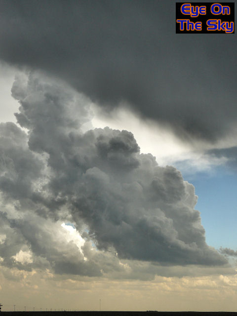 |
| Whilst
parked up beneath the storm's anvil (top of picture) more solid cumulus
was erupting to our south and east. . |
 |
| Smoke
drifts from a grassland fire triggered by a lightning strike just a few
hundred metres from our car. Fire crews were arriving as I took this shot
(right of picture). . |
 |
| Another
ragged wall cloud developed from the storm's base as we looked on, and
yet another funnel cloud grew. Chasers nearer to the circulation reported
this as a tornado though we were uncertain. . |
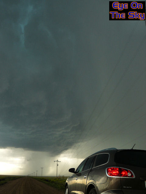 |
| The
storm began to look very outflow dominant as we continued to head south
towards Campo, with this huge and impressive downdraft of hail preceded
by a solid, newly developing updraft. . |
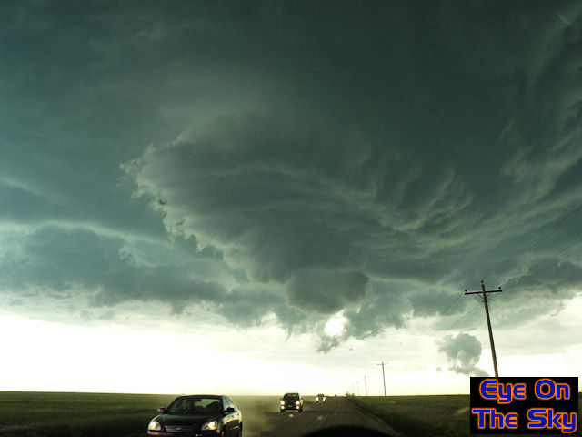 |
| The
degree of rotation within the base of this new updraft was staggering.
Parked up in Campo, we looked west as chasers rapidly fled back eastwards
to escape from under the rotation. . |
 |
| As
if it were becoming a common sight, yet another ropey funnel cloud dropped
from the storm's base as we pulled a 180 and headed back southwards from
Campo. . |
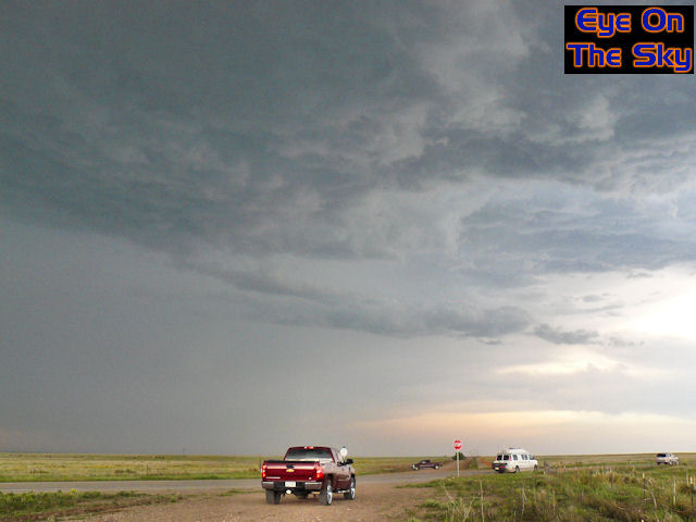 |
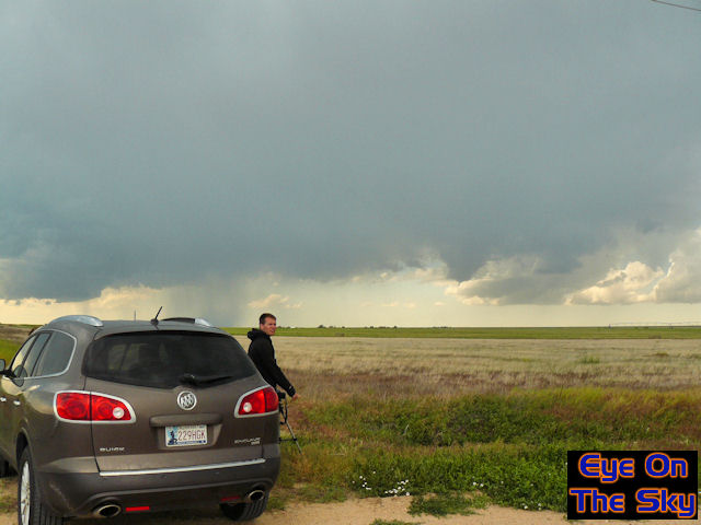
| This
was our stop-off point several miles south of Campo. There were a number
of chasers here, ready and waiting for the storm to roll in from the north-west. . |
 |
| As
the storm's updraft sat overhead, extremely sporadic hailstones were being
chucked out, making patting sounds in the surrounding fields. At this
stage, they were golf ball sized or smaller. . |
 |
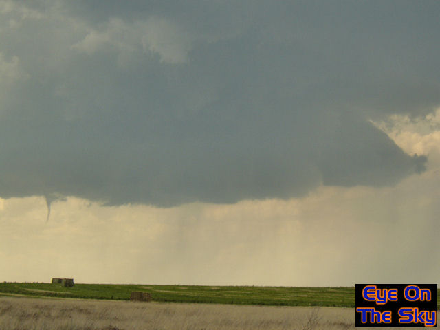
| It
was now mid evening, and the show really began. Matt pointed out this
developing funnel, almost overhead though ever-so-slightly south of us.
Chasers along the road held their nerve to see where this would head.... . |
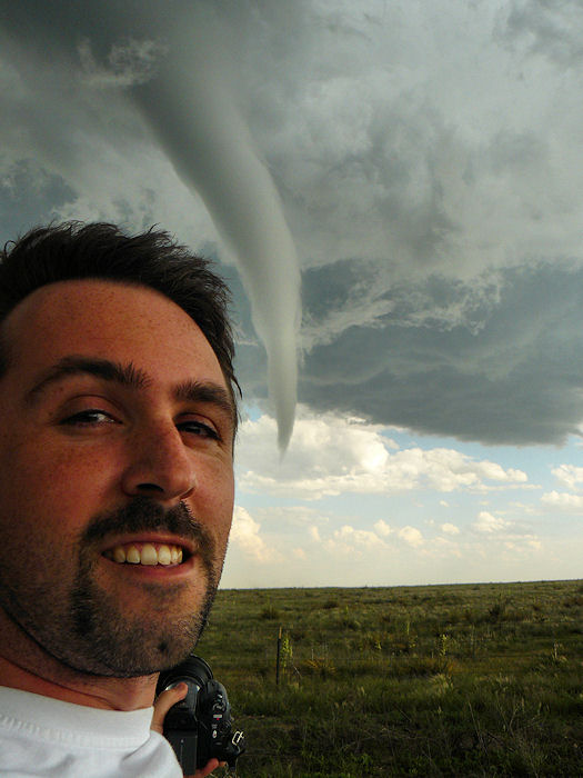 |
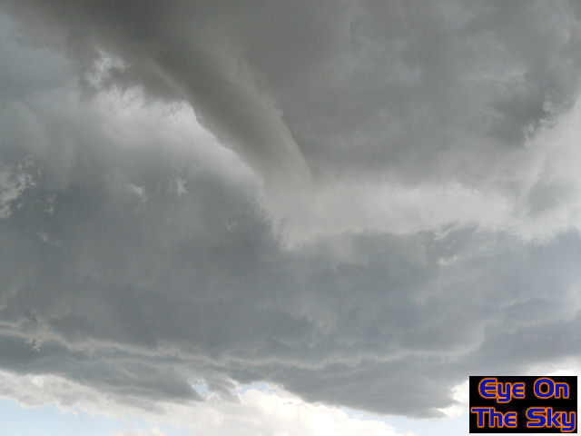
| The
funnel quickly became spectacular and stretched well beyond the halfway
point to the ground. A quick personalised shot was needed before the action
really took off! . |
 |
| Matt
and Paul snap and video in sheer disblelief as the vortex slams down to
the ground just over the hill. It took mere seconds to reach this stage
from not existing at all! . |
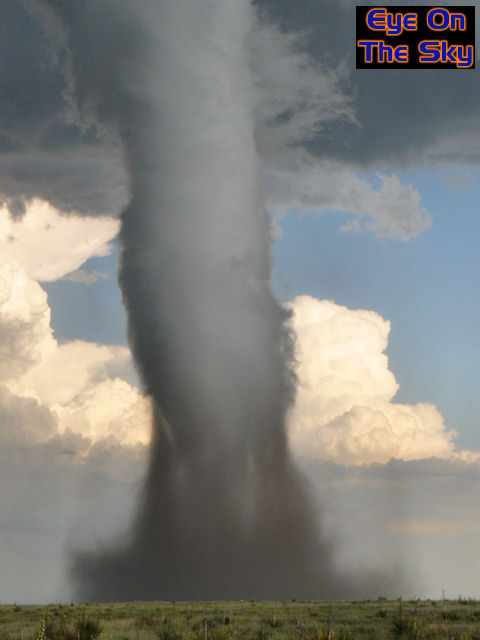
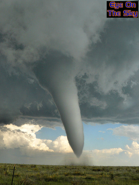 |
| The
'elephant trunk' tornado quickly began to thicken up, becoming more stovepipe
in appearance. The first dust began to kick up too beneath the tornado's
base. . |
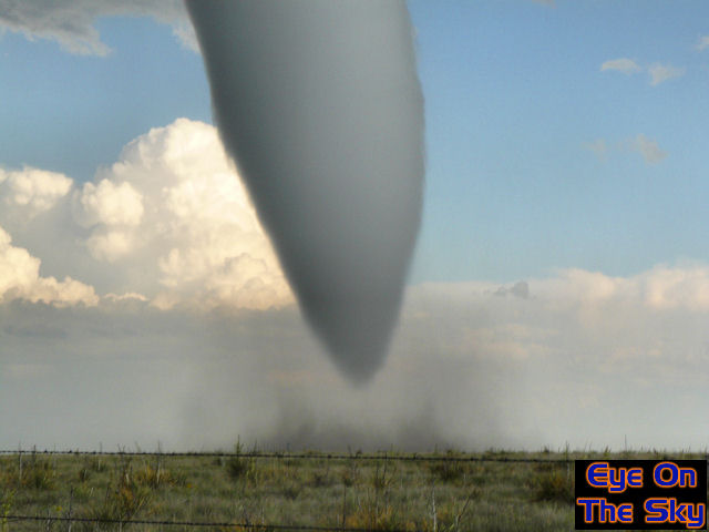 |
| A
zoom in of the twister's base and the dust being kicked up. The vortex
looked so perfect and polished that one could imagine being able to see
your own reflection in the condensation! . |
 |
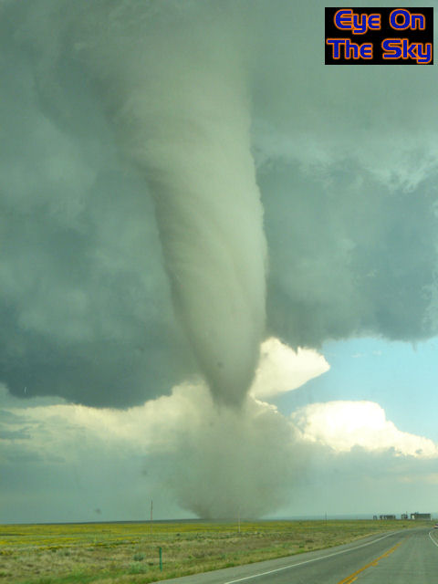
| As
the dust and dirt around the base of the tornado grew larger and larger,
it allowed the tornado's shape to become even more stovepipe-like. The
roaring noise from this was incredible. . |
 |
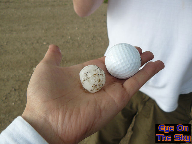
| In
order to escape the golfball and cricket ball sized hailstones (lying
on the road in this picture), we had to flee towards the tornado, timing
its crossing across the road perfectly so we weren't wrapped up in it. . |
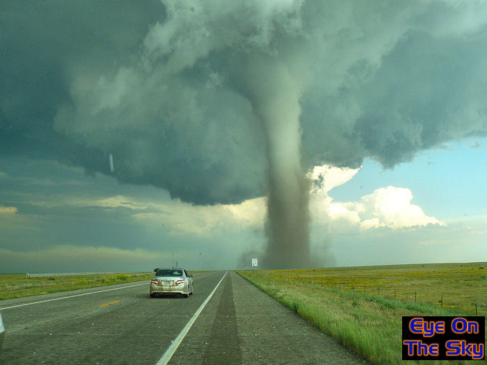
 |
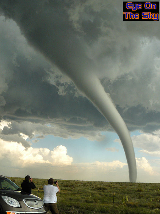
| At
this point, I was driving the car towards the tornado amongst the stampede
of excited chasers. This shot, taken by Helen, shows just how close we
were getting to the tornado's huge structure! . |
 |
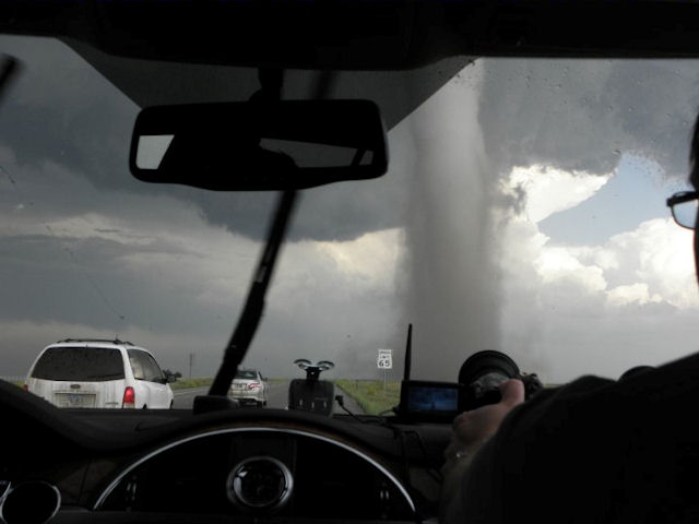
| The
tornado had just crossed the road in front of us and was now east of the
highway. Amazing, rapidly-rotating striations can be seen circling the
tornado vortex. . |
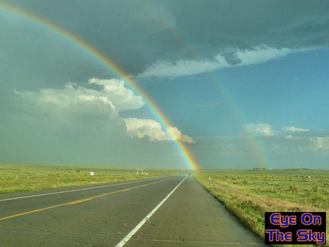 |
| We
puched out the southwest side of of the storm, away from the tornado and
hail, and were greeted by this simply stunning double rainbow. . |
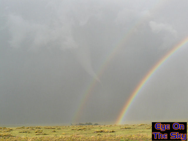 |
| The
opposite side of the rainbow was even more stunning though, as the tornado
was still going, intersecting the arc of the secondary bow. At this stage,
the tornado was a little more roped. . |
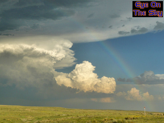 |
| As
the anvil of our storm loomed large overhead, another storm was erupting
to our south-east, and the cloud structure looked staggeringly solid. . |
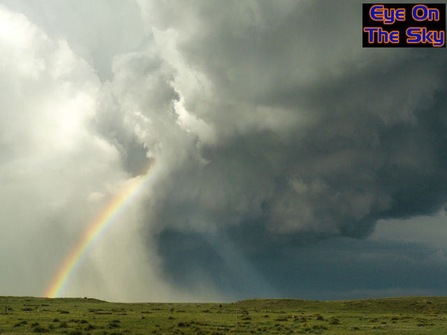 |
| As
the RFD thundered through us, stabbing chasers with tumble weed, curtains
of hail were being wrapped around the tornado, obscuring if from our view. . |
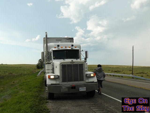 |
| This
big rig driver was so impressed by seeing the tornado that he stopped
to have a chat with us. The sides of his trailer had been ripped open
by the RFD winds. . |
 |
| We
followed the storm eastwards towards Guymon as sunset approached, almost
venturing into Texas. The storm updraft was stacked and almost mothership-like
in appearace, with frequent lightning. . |
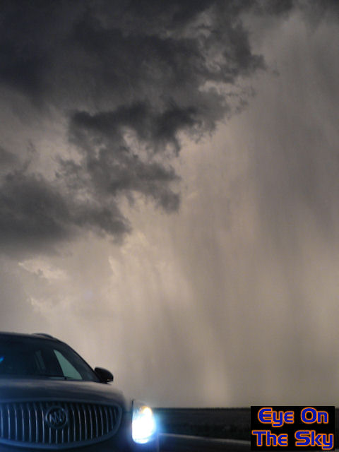 |
| Sheets
of golf ball to cricket ball sized hail were never far behind us though,
so every stop was only for a few minutes before we'd have to move on.
We didn't want any more dents today! . |
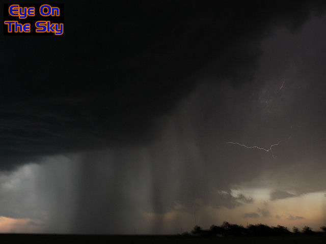 |
| One
final shot of lightning flickering through the thunderstorm downdrafts,
before we ultimately lost the light and headed to our hotel in Guymon. . |

| Day 14 :: Home :: Day 16 |