|
>Invisible
Anvil
North Wales 30th April 2004 |
||
|
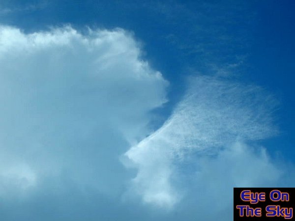
A
growing cumulus cloud: Fully-blown
cumulonimbus with anvil: So why is this report called 'Invisible Anvils'? Well, to help explain, the image below was taken in North Wales in the spring of 2003. At face value, it shows a developing thunderstorm with the anvil beginning to spread from left to right at the top of the image. However, on closer inspection, something else is going on.
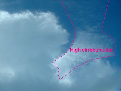
On this image below, we've highlighted an area of cirrocumulus, which is the highest cloud variety on this photo. About 10 minutes before this image was taken, this patch of cloud was much larger, covering the area of sky where the developing Cb was headed:
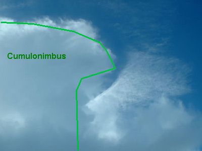
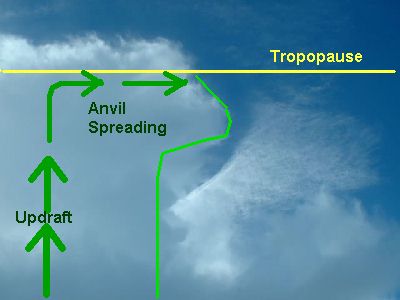
On this next image, we've highlighted the growing cumulonimbus cloud, or thunderstorm:
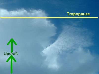
This following image shows what's happening inside the growing cumulonimbus. Updrafts of air are rising at great speed inside the cloud, just like the bubble of wax in a lava lamp (as mentioned earlier):
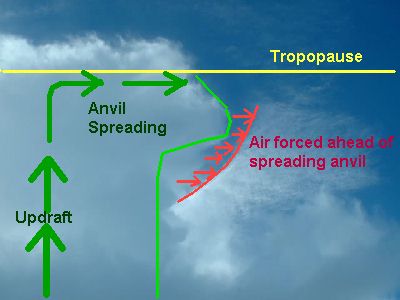
Finally, the part of the image giving this report its title, the 'invisible anvil'. Air is flying outwards so fast in the anvil, that it's actually ramming into the air ahead of it. This clearer, drier air is then crashing straight into the cirrocumulus clouds, and through rapid evaporation, is wiping them out of the sky (shown here by the red arrows):
This is something the EOTS team have very rarely seen, and despite being a simple mechanism, we've yet to see it again! Please let us know if you've captured something similar on camera!
|
||