The
Chase - continued
Click all photographs for larger copies
Below
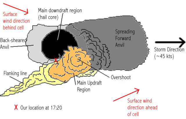
is a schematic plan-view diagram which we have produced to roughly simulate
what we observed within this individual storm.
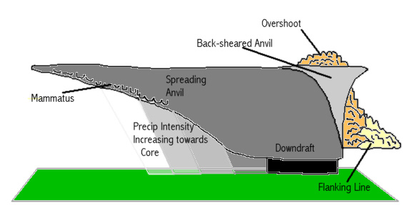
As discussed earlier, a forward-spreading anvil was observed travelling eastwards
from the main core of the storm. This is indicated below in dark grey. The
main downdraft of the storm was very evident, as illustrated in previous photographs.
This is indicated below in black. Once we punched the core and travelled through
to the south side of the main downdraft region, we were presented with a view
of an impressive flanking line further to the south, running roughly WSW to
ENE (as shown in yellow). To the far west the flanking-line convection was
shallow, becoming progressively deeper as it approached our position. The
main rain-free base of a single large updraft was just to our south-east and
east (as shown in orange), and a clear over-shooting top could be seen (see
later photographs). Although the sun was low in the sky, thus allowing sunlight
to filter to our location, the sky directly above us and to the west was filled
with a back-sheared anvil (as shown in light grey).

In order to confirm this structure, the following set of diagrams displays the storm from various locations, and compares schematics to actual photographs taken.
Firstly, as displayed earlier, one would expect to see the following when viewing the storm from the east. Although the forward anvil was spreading far in advance of the storm, much of the precipitation falling from the anvil was fairly light. Therefore, one would expect to see a long way into the storm, almost towards the main core, as follows:
Schematic
Actual
image
Secondly, if viewing the storm from the rear, one would expect to see a well-developed back-sheared anvil, and a flanking line on the right-hand-side of the storm rising into a main updraft and over-shooting top at the top of the storm. Provided the observer's distance from the cell isn't too great, the main hail and precipitation downdraft would be seen towards the left-hand-side of the storm, as follows:

Schematic
Actual
photograph
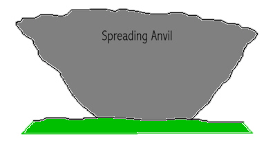
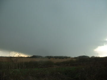
Thirdly, a side view of this cell would give away clues as to the horizontal
scale. The following diagram is what the cell should look like as viewed from
the north towards the southern horizon, based on our observations and schematics.
The spreading anvil would occupy the vast majority of the storm's length,
sprawling downwind in an easterly direction. The back-sheared anvil would
be evident, but would not expand over as great a distance as the forward anvil.
Provided the onlooker's elevation is sufficient, then precipitation would
be seen increasing in intensity, from the anvil to the main downdraft. Finally,
depending on their horizonal and vertical extent, an overshoot and flanking
line would be seen.
Schematic
Actual
photograph
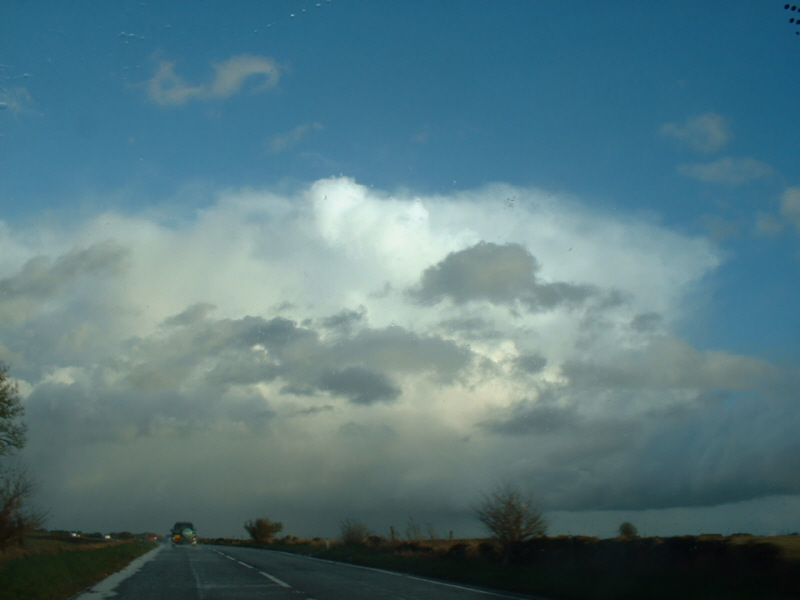
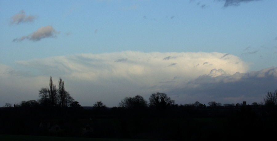
The
stunning photograph above was taken by Sam Jowett, who was viewing it one
mile due east of Towcester, Northamptonshire, approximately between 1700 and
1730 GMT.
His location was over 40 miles north-east of the cell, which gives the impression
of just how massive this storm was. It is clear from the image, as well as
other images, that this storm was indeed comprised of one single cell (comprising
of an updraft and a downdraft region). In the UK it is rare for single cell
storms to be so persistent and so large without being part of a multicell
structure. It is at this point that one has to consider the possibility that
this storm may well have been a supercell.
The implications of this observed structure, its relation to the radar, and
significance of rotation and supercell structure will be studied later.
However, this is far from the end of the story regarding our rendez-vous with this stunning thunderstorm.