The
Chase - continued
Click all photographs for larger copies
All radar images are used with permission from PA Weathercentre.
The following set of radar images and photographs all represent the period from 1700 GMT onwards. It was at this point that the storm began to reach our location, close to Burford, and we could see a solid core of hail approaching from the west through a west-east orientated valley.
1715
GMT - The main core of the storm now explodes into life, with >30mm/hr
intensities recorded on radar; at this point much of that would be hail. The
radar returns east of Burford were not reaching the ground in their entirety,
illustrated by the next photograph.
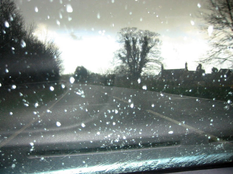
1715
GMT - This image was taken about 2 miles north of Burford looking directly
south, beneath the lowering anvil. Although precipitation was indicated by
the above radar image, it was not reaching the ground thus allowing brighter
skies in the distant south to remain visible.
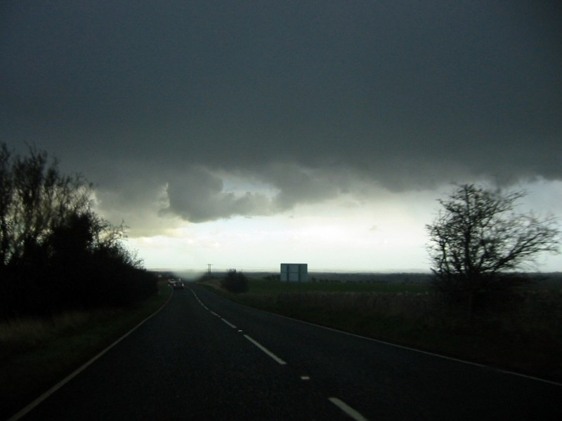
Whilst the cell was moving eastwards, we travelled southwards from our previous location in an attempt to get in front of the downdraft core. We were caught up in traffic in Burford just as the main downdraft began to arrive. Preceded by sleet, a spell of heavy snow began to fall, as shown in the next image.
1721
GMT - Travelling about 0.5 miles south of Burford, precipitation consisted
of torrential rain and snowflakes. However we were aiming for the brighter
skies on the south-east side of the main downdraft, as seen in the distance
in this image.
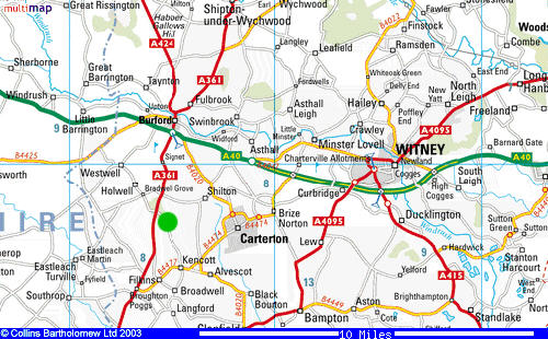
This
map shows our chosen location from where we observed the storm, about 3 miles
south of Burford, just east of the main A361. We arrived at this location
at about 1725 GMT.
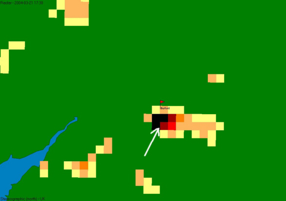
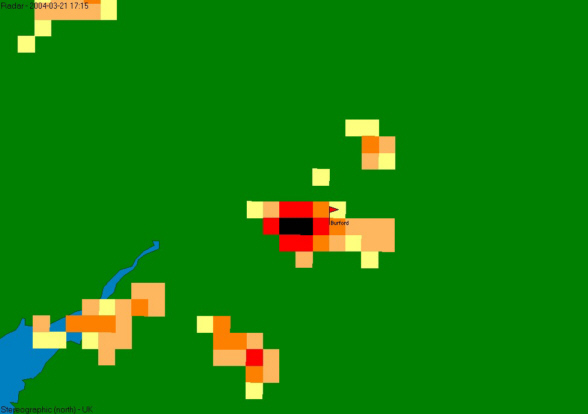
1730
GMT - The area of >30mm/hr intensity precipitation increases yet further
in size, forming a "hook" shape within the main downdraft region.
Our final location at 1730 GMT is shown approximately by the arrow, towards
the southern edge of the main core.
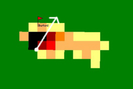
The
following images, taken between 1725 and 1730 GMT, correspond to the radar
slide immediately below. The white disc indicates our position relative to
the storm cell, and the arrow indicates the direction in which the photographs
were taken.
NB:
The photographs are displayed excatly as captured, meaning they appear rather
dark. In order to see the cloud detail, you may have to adjust your monitor's
contrast settings.
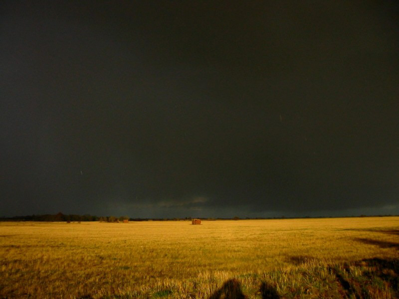
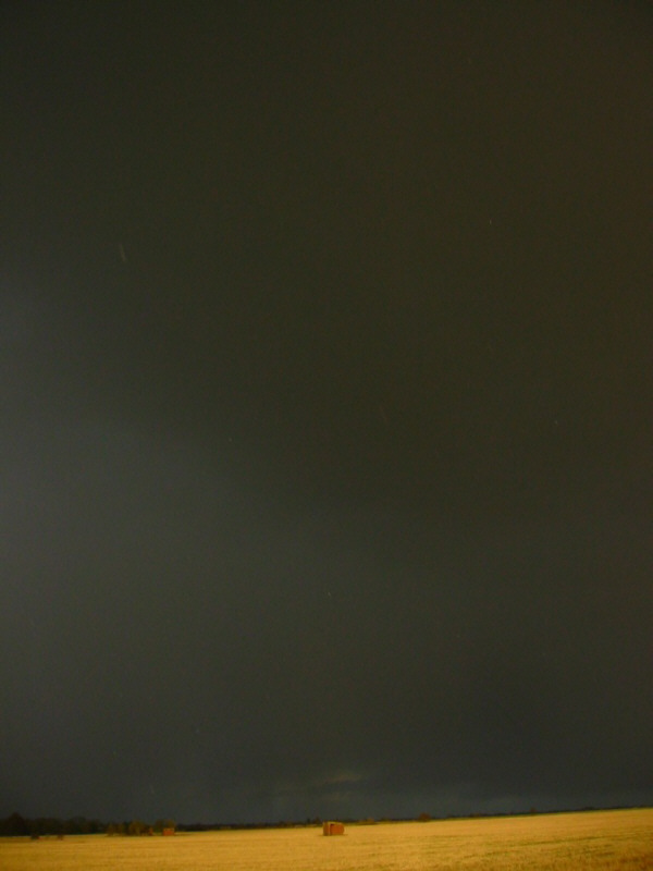
The
two images above were taken looking north-eastwards. In the first photograph,
a cloud structure resembling a weak wall-cloud with associated 'beaver's tail'
can be seen in the centre and to the right of the image. To the left of the
image is the main downdraft core of rain and hail.
In the second photograph, the top half of the image is filled with the rain-free
updraft base
which can be distinguished from the hail-filled downdraft to the left of the
image.
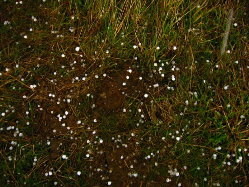
Our location was towards the southern edge of the main downdraft as it moved eastwards. In no time at all, hail began falling onto our position. The following images were both taken at 1729 GMT and show that the hail was between 7 and 13mm (between 0.3 and 0.5 inches) at this time.

Now would be an appropriate time to discuss the structure of the storm cell, in order to appreciate further images and discussion of this storm.