The Chase
Now that the scientific overview is out of the way, it's on to the real reason we all strive hard to understand storms - the simple love of witnessing them!
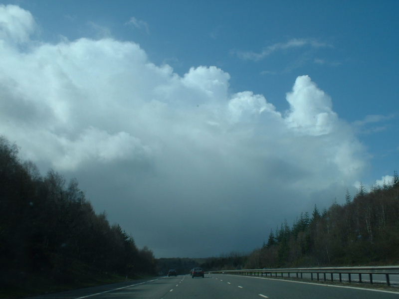
We spent much of the afternoon witnessing many cumulonimbus developments, the majority of which produced moderate showers, some with hail. Our initial trip took us from London westbound, along the M4.
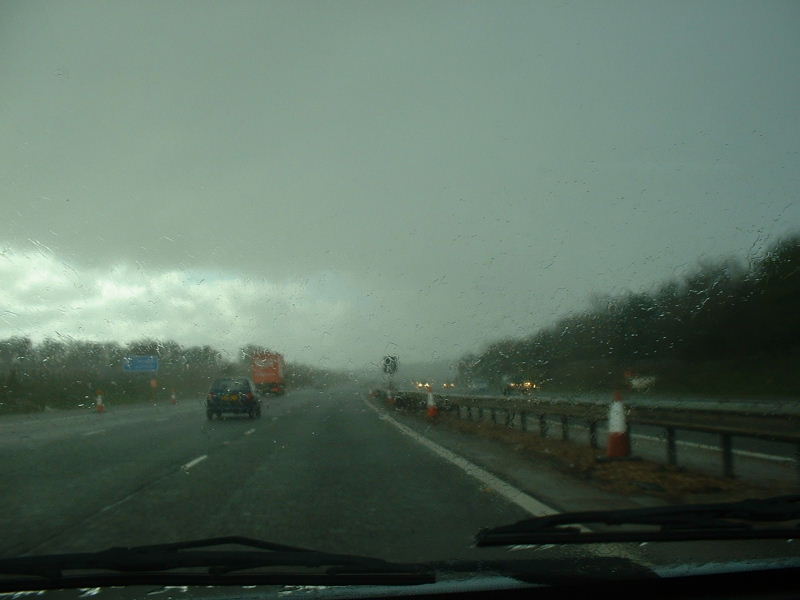
Near the M4/A34 junction at Newbury we drove through a quite lively cell, which produced some very heavy rain for a short time, and also some small hail. The following images show this potent shower, during which gusts of wind blew the car dangerously from side-to-side.
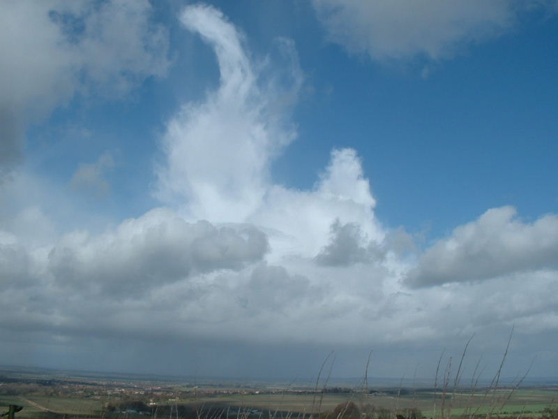
Other showers provided very stunning photographic opportunities, such as this narrow but extremely high anvil above Oxford at around 2pm (this image is taken from the Ridgeway).
However, as we were busy chasing small but locally intense showers around Gloucestershire and Oxfordshire, over 150 miles away off the coast of Pembrokeshire a developing shower would later prove to be quite something!
The
following set of radar images show the development of this cell, and its rapid
movement towards the part of the world we were patrolling. The cell is highlighted
throughout, occasionally becoming obscured by other developing showers, but
always maintaining its individual integrity.
The small red flag on the radar images is centred over Burford, which would
later see the severe thunderstorm.
All radar images are used with permission from PA Weather Centre.
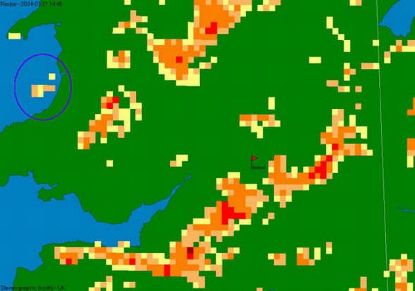
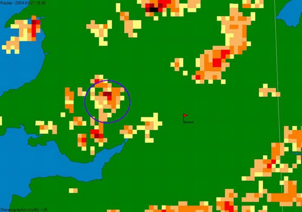
1445
GMT - A small cell develops in the general flow west of Aberystwyth.
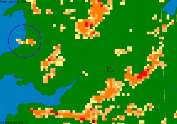
1500
GMT - Cell elongates and develops with the wind direction. Max rainfall intensity
1mm/hr.
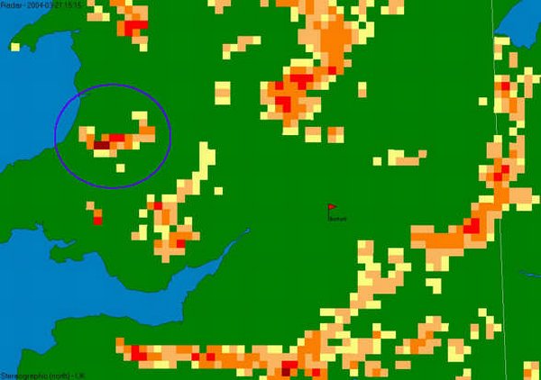
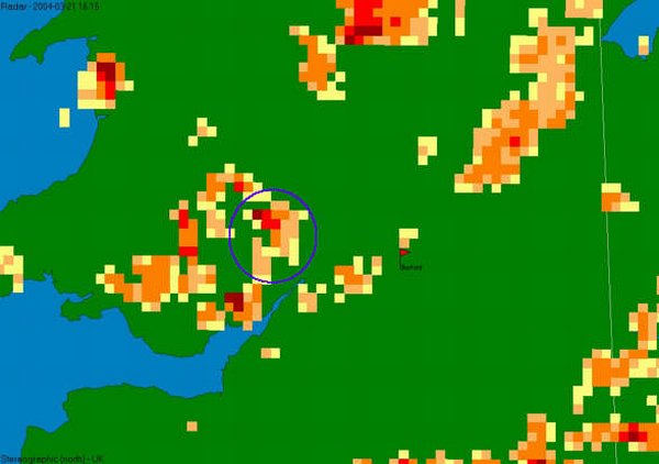
1515
GMT - Already a dramatic increase in intensity and size. Max intensity 10mm/hr.
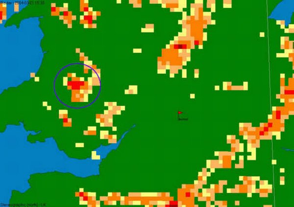
1530
GMT - Cell loses maximum intensity, but continues to increase in size. Max
intensity 3mm/hr
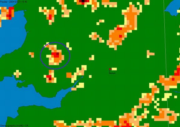
1545
GMT - Further increase in intensity, with >10mm/hr being recorded.
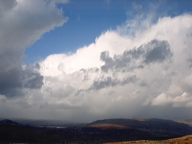
1545
GMT - This photograph is looking north from the B4560 near Llangynidr in the
Brecon Beacons. The photographer, Andrew Davis was south of the cell, which
at this point corresponds to the 1545 GMT radar above and was giving a downpour
over Hay-on-Wye.
1600
GMT - Front edge now reaching the English border. Max intensity >10mm/hr.
1615
GMT - It is at this point that the cell starts to exhibit a distinct structure.
This is explored on subsequent pages.
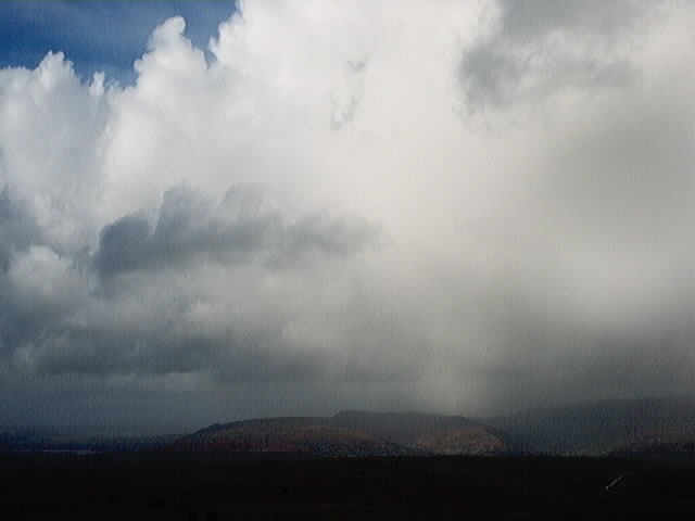
1615
GMT - This photograph, also taken by Andrew Davis shows the same shower 30
minutes later, this time in a more north-easterly direction.