Cader Idris - Snowdonia
Photographs
Page 1
22nd
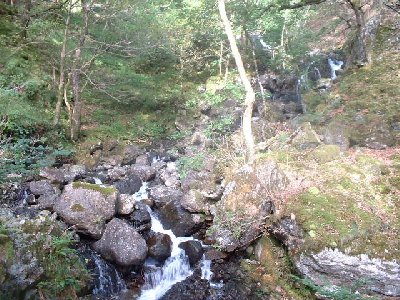
September 2002. The walk begins with a steep ascent through woodlands, adjacent
to the base car-park at Minffordd. This part of the route can be especially
wet and muddy in winter.
A
climb of about 150m through the heavy woodlands leads you to the treeline
at 250m above sea level. Here, the first views of Cader Idris' granite outcrops
appear.

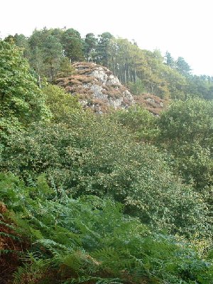
Rounding
an outcrop at about 400m above sea level, and the view of Penygadair's rocky
ridge lines the horizon.
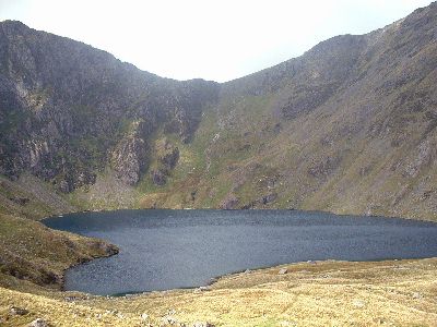
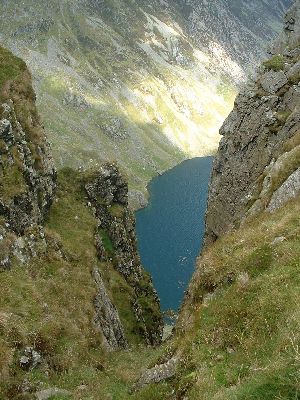
Eventually,
we arrived at Llyn Cau, a glacial lake in the main cauldron of Cader Idris.
The lake lies around 470m above sea level. The next step, is to head left
off this image, and over the top of the ridge in the background.

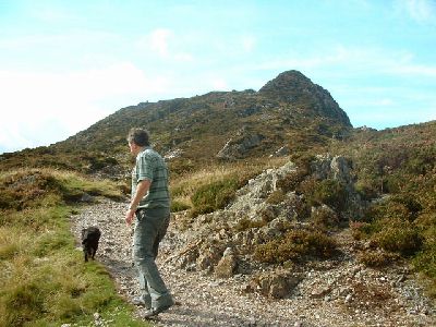
On
the ascent to the main ridge of Craig Cau, we traversed up the flanks of
Craig-Lwyd, on the well-marked Minfordd Path. This provides stunning views
southwards towards Mid Wales.
...and
here's the view westwards along the ridge of Craig Lwyd, with the summit
of Craig Cwm Amarch ahead, standing at 791m above sea level. Here in shot,
is my dad, Bryn, and Beej, who's sadly no longer with us.

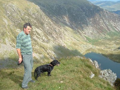
From
the same spot, a view northwards reveals the imposing ridge of Cader Idris,
and the summit at Penygadair. At the base of the image, is Llyn Cau. Please
click here for a
larger panoramic shot (~0.5mb).
Almost
arriving at the summit of Craig Cwm Amarch, standing at 791m. In the background
and sunlit, is the slopes of Penygadair, the final climb to Cader Idris'
summit.
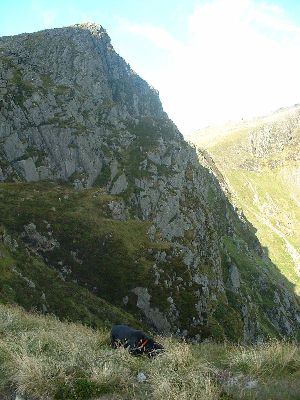
Don't
stand too close!! A near vertical gash dropping some 300m from Craig Cwm
Amarch to the lake below.
The
summit of Craig Cwm Amarch, looking eastwards back to Llyn Cau. Behind my
dad is the slope of Penygadair.