White Christmas 2004
Hope,
Flintshire, Northeast Wales
December 24th-27th 2004
Speculation that many parts of the UK would receive their first white Christmas in years reached fever pitch in the week before the big day, and forecasts were becoming more and more confident that many parts would indeed see some snow. The prospect for North Wales was always ranking amongst the best, as the predicted northerly wind would guarantee snowfall across the region, courtesey of the North Channel effect. More fondly known as the "Cheshire Gap" phenomenon, northerly winds blast across a long sea-track, from the west of Scotland, through the North Channel, before striking the coast of North Wales. This sea-track allows plenty of moisture to be picked up, and with enough instability shower after shower often pounds North Wales and Northwest England.
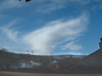
The northerly wind was forecast to set in during the evening of Christmas Eve, with the first of the snow showers arriving during the early morning of Christmas Day. At 8am on Christmas Day, I woke up to see overcast skies with flurries of light snow, although the colour of the distant mountain hinted at earlier heavy snow showers.
The
early morning snow flurries cleared at 9am on Christmas morning, leaving
behind blue skies, snow-dusted hill tops and whispy anvils from decaying
showers.
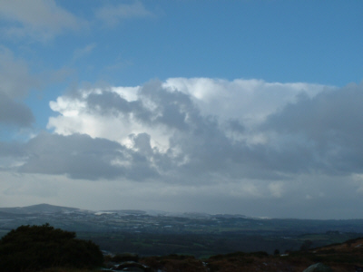
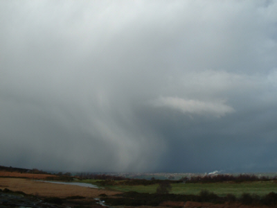
I peered northwards from my window at 11am to see a mass of cumulonimbus clouds. These were actually the front edge of a trough drifting southwards through the Irish Sea. As they neared, they began towering over the village of Hope, threatening a white-out.
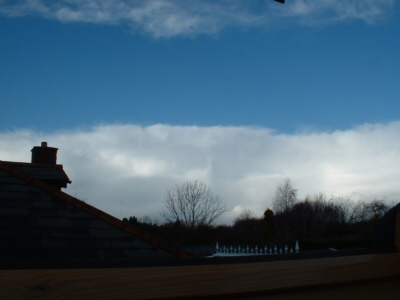
The
front edge of an arctic trough, marked by a battlement of towering cumulonimbus
anvils.
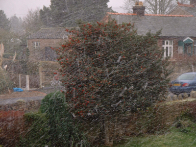
Minutes
later, and the snowfall arrived. This lasted for around half an hour, although
only resulted in a light dusting.
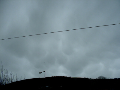
Some of the best mammatus I've ever witnessed have been from winter snow
showers, and living up to expectation, these superb mammatus buldges flanked
the underside of the departing trough.
The following link provides a time-lapse video of the passing trough. The first scene shows the towering cb clouds moving towards the village, whilst the second scene shows the arrival of the snowfall, with passing mammatus on it's rear edge. Notice just how squally it gets during the height of the blizzard. The video is approximately 3.2mb and is in WMV format:
http://www.eots.co.uk/reports/Xmassnow1.WMV
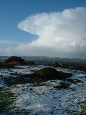
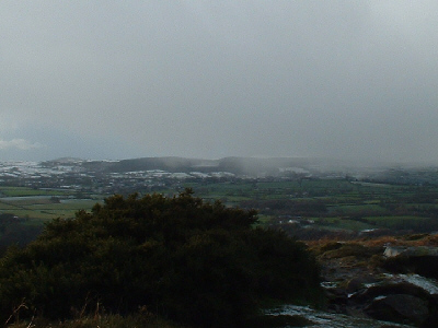
Only a couple of miles from the village is the ridge of Hope Mountain. At only 330m asl, it's not really a mountain, but it does mark the last point of high ground before the Cheshire Plain. For this reason, it has a view somewhat unrivalled along the Welsh border, and on a clear day one can see as far north as Scafell Pike, as far east as the Peak District, as far south as the Shropshire Hills, and as far west as Snowdon. In cold northerlies, I've often witnessed spectacular scenes as snow showers blast their way across the Cheshire Plain, and this Christmas Day was no exception!
I
arrived on the mountain at around 2:30pm, and this first image is looking
north-westwards towards Moel Famau. Skies were sunny and blue overhead,
but on the northerly horizon this cumulonimbus was growing and moving right
towards my location.
Ten
minutes later, and the shower started to develop a well-defined anvil, symmetrical
from west to east as seen here.
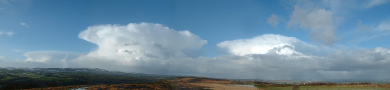
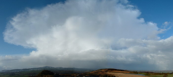
The shower wasn't alone though, it was a twin! This panoramic view extends
from north-west, through north to north-east. To the left of the image is
Wales, and the Clwydian Hills, in the centre is the Dee Estuary and the
Wirral, and to the left is the north of the Cheshire Plain and Liverpool.
A larger version of this image can be found at the following URL, and is
approximately 1mb in size. On the larger image you'll notice a third
anvil to the left of the image, and over the Wirral, just right of centre,
streaks of snow can be seen falling.
Larger image: http://www.eots.co.uk/reports/07pano.JPG
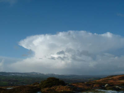
Another
view of the stunning anvil, approaching the snow dusted Hope Mountain.
Here's
another panoramic shot, this time concentrating on the major westerly cell.
This cloud looked almost text book in appearance - it was the classic incus
formation! A larger version of this image can be found at the following
URL, and is about 850kb in size.
Larger image: http://www.eots.co.uk/reports/09pano.JPG
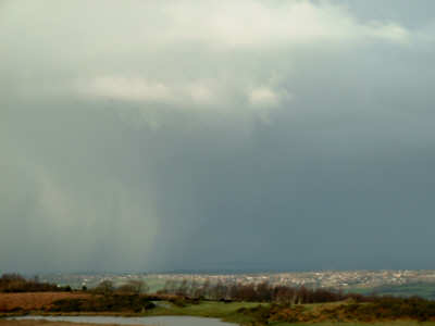
As
the shower approached the area from the north, vast streaks of snow could
be seen racing ahead of the main cell. The snow first began to fall over
the Dee Estuary, as seen in the image above. The streaks of snow were falling
just behind a gust-front cloud, which can be seen in this image above the
fallstreaks:
Another
view of the approaching snowfall.
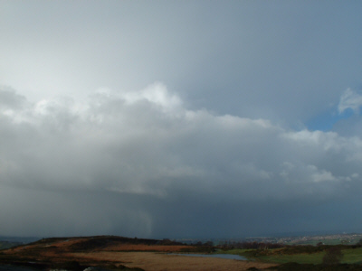
At
the same time, the second cell (as seen to the right of this shower on earlier
images) began dumping snow over the Cheshire Plain:
The
heavy snow gets perilously close to the town of Buckley, Flintshire:
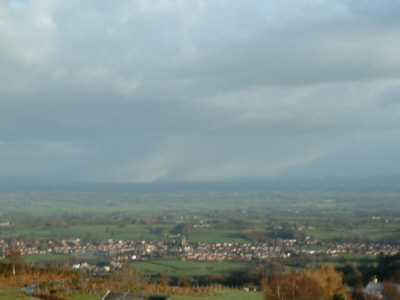
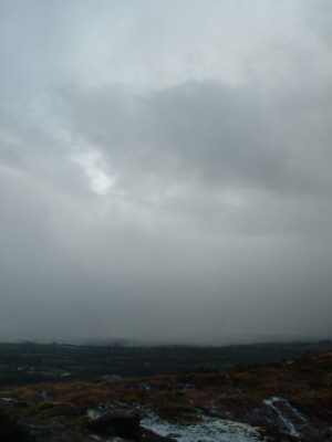
Meanwhile, to the north-northwest, the sheets of snow were moving closer and closer to my location, as shown in the next couple of images:
The following timelapse displays the approach and development of this stunning cumulonimbus, and also follows the snow's progress across the Cheshire Plain. It finishes with realtime footage of the snow falling on Hope Mountain. Again, the file is in WMV format and is about 1.3mb.
http://www.eots.co.uk/reports/Xmassnow3.WMV
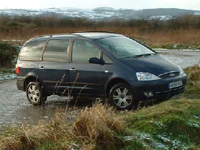
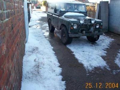
My
borrowed snow-chasing vehicle, just before the blizzard arrived :-).
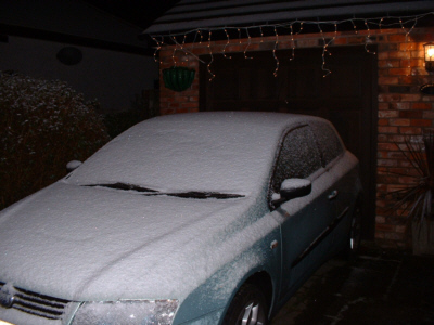
By
the time I returned from the mountain, darkness had fallen. The shower had
left around 2cm of cover across the village of Hope (roughly 90m asl). Here's
my car, with a nice sugar-coating from the earlier snowstorm!
Snow showers continued on and off throughout the evening and first part of the night, although were often of soft hail as well. After 1am, the showers died away and clear skies moved in. Temperatures quickly plummeted, and a widespread hard frost set in, turning the snow cover into a solid, icy coating. However, the quietness was shattered shortly after!
I suddenly woke up at 5am, with the notion that the whole bedroom had just lit up for a second. Before I had time to decide whether I was dreaming or not, a deafening peal of thunder shook the house. Thereafter, there were several more close-proximity lightning flashes, with equally deafening thunder. Then the heavens opened, and light snow turned to smashing hail! Each hail stone was at least 1cm in diameter, and some seemed to be even bigger. They were turned horizontal by winds which must have been gusting at up to 60mph, perhaps more. At the height of the storm, over an inch of hail was lying, and lightning continued to light up the night sky. I received several text messages during the storm from friends who live in the village, all to the tune of "What the hell is this??". As soon as the hail abated, torrential rain began to fall, and each rain drop froze to the ground in a dense sheet of ice. The road appeared to be ok, but our driveway turned to a solid ice-rink!
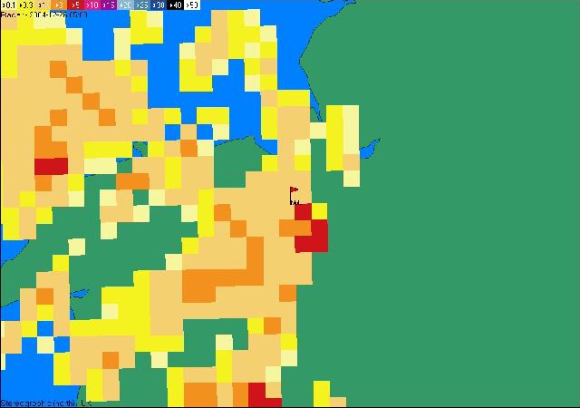
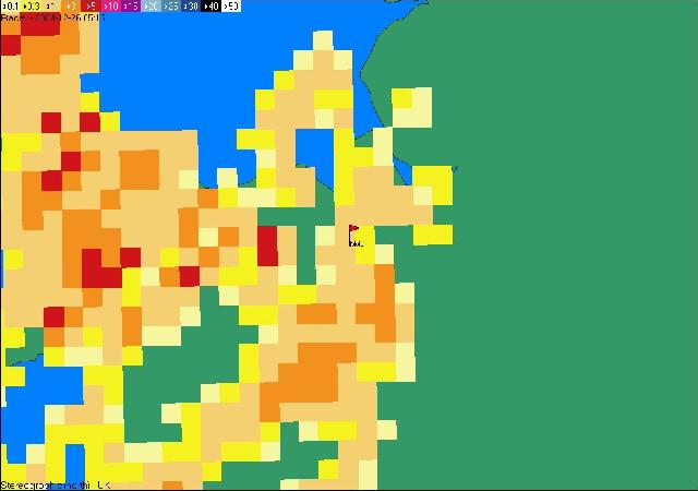
The
following radar slides show the thunderstorm crossing the region, between
0415 and 0515. The small red flag indicates the position of Mold. The white
pixel is >50mm/hr, then purple pixel is >15mm/hr, the pink pixel >10m/hr
and the red pixel >5mm/hr. Radar images are copyright the
PA Weather Centre.
0415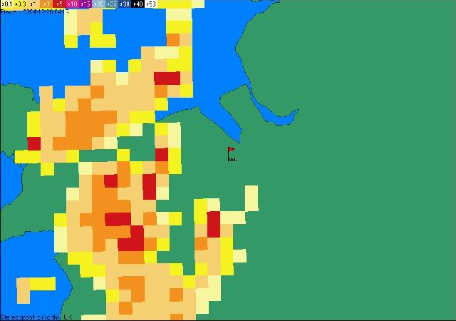
0430
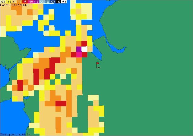
0445
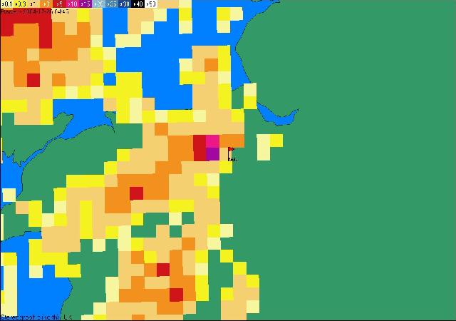
0500
0515
According to the radar images, the thunderstorm reached it's peak just inland from the North Wales coast, near the town of Holywell. An account from a nearby resident confirmed that the storm was indeed violent, with strong winds and large hail. The following images show the size of the hailstones, and also some of the damage caused.
All images are taken from http://emlyn.cooke.fireflyinternet.co.uk/wx/hailboxingday04.htm with kind permission of Emlyn Cooke. Please do not use his photographs without permission. (date should read "26.12.2004".
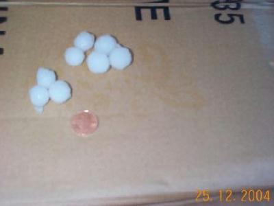
The
hailstones compared to a 1 penny coin.
Large
drifts of hail on Boxing Day morning.
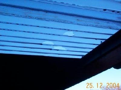
The
hailstones were large enough to punch holes in this carport roof!
No sooner had the violent thunderstorm arrived, but it had gone, and clear skies returned just 25 minutes after the storm appeared. However, temperatures before the storm were around -0.5C, and once the storm had passed they were nearer 4C. They stayed that way for the rest of the night. The storm was reported to have caused hail damage in nearby towns and villages, and the wind had brought down numerous trees and telephone lines!
So, a white Christmas it was for 2004. Not tonnes of snow, but more than enough to give that festive spirit. With a helping of thunder, driving winds and cracking hail stones, not to mention sunny skies and hard frost, the Christmas 2004 weather-stocking was bursting at the seams! ;-)