The
Filkins-Broadwell Tornado
Click all photographs for larger copies
We arrived in Filkins at around midday on Thursday 25th March, and the first sight we were greeted with was a row of enormous trees stripped as if put through a shredder, a flattened wall and downed power lines. Before we arrived, we weren't quite sure what to expect - perhaps some broken twigs, maybe some downed slates; the initial sight gave us a stark realisation that we had something much bigger on our hands!
Our trip to Filkins had several purposes. Firstly, we wanted to know exactly what had happened here. Was it straight-line winds, a microburst, or a tornado? The quest to find the answer would require careful examination of the type of damage, the extent of the area comprising damage, and eye-witness reports.
The first port-of-call was the local pub, situated in the centre of the village. We weren't already desperate for the first pint of the day, we had simply decided that the pub would probably be one of the gossip points of the village, and could thus provide a wealth of eye-witnesses. We enjoyed a bite to eat, and although we didn't actually meet anyone aside from the landlady, we left our details and contact number with her in case anyone would wish to contact us.
Our plan was to exhaustively comb every possible area of damage in the village, chat to as many people as we could, and be happy with the village situation before we headed out into the surrounding countryside. Filkins is just off the main A361 Swindon to Burford road, on the Gloucestershire/West Oxfordshire border.
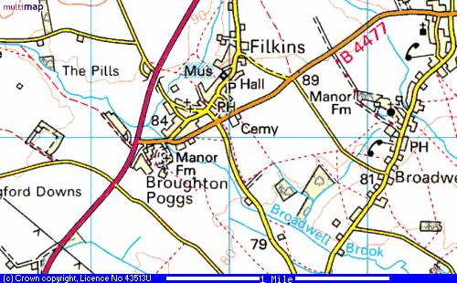
From
www.multimap.co.uk
We had planned our investigation logically, thus decided to head to the furthest western point of the village, next to the main A361 at Broughton Poggs.
On the following aerial photographs, red circles indicate trees severely damaged (i.e. in need of felling) or uprooted. The numbers refer to photographs taken at the scene.
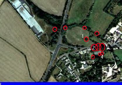
A361
and Broughton Poggs.
Image from www.getmapping.com
(1)
North
of the village road, in the centre of an open meadow, this large oak tree
never stood a chance. The tree's trunk was snapped like a matchstick, and
fell in an easterly direction. Trees in the background are also damaged.
(2)
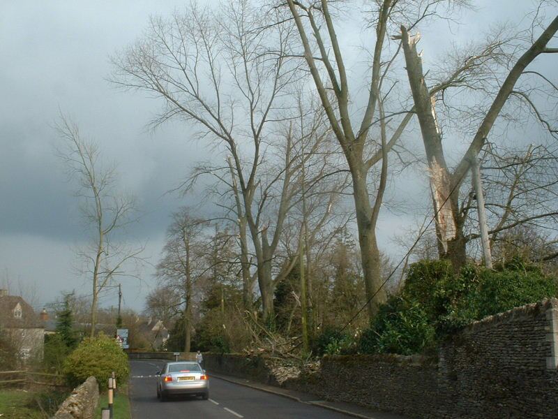
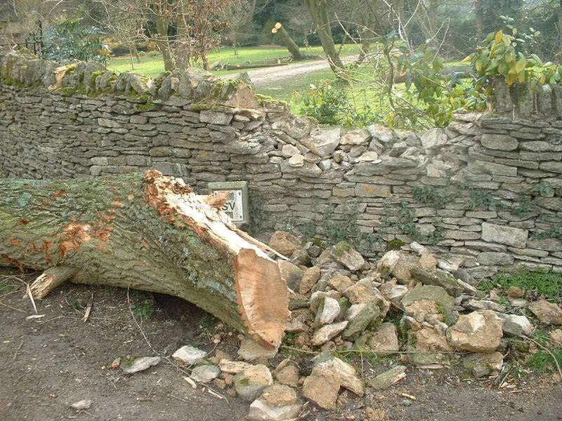
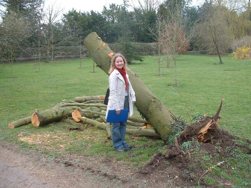
Running parallel to the village road, and bordering Broughton Poggs Manor's gardens, were several very large trees indeed. Some of these Poplar trees were up to 150ft tall, and literally towered over the road. One of these trees was completely flattened, falling across the road and demolishing the walls on both sides. The other trees were stripped to the trunk, with their debris reported to have blocked the road up to 100m from where they once stood. One eye-witness described seeing the trees bending suddenly, their tops being twisted in a cork-screw motion. Then with one loud crack, they piled onto the road, narrowly missing a passing car which just managed to stop in time. The trees also brought down power lines, as seen below. All of these trees fell in a north-easterly direction.
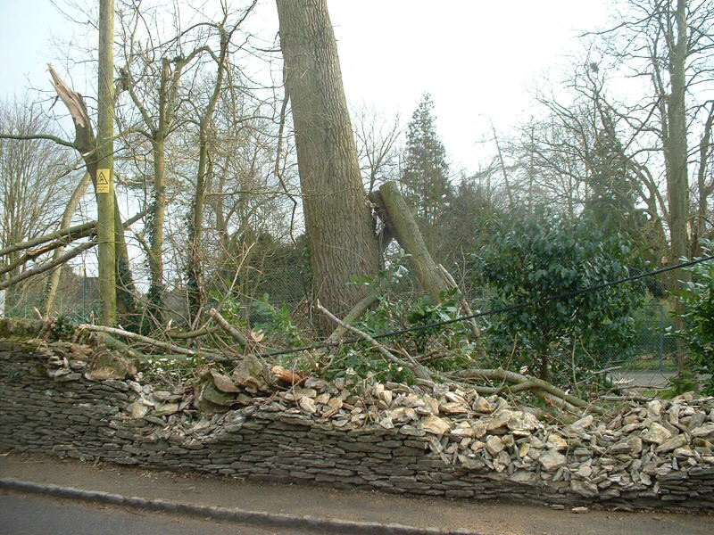
(3)
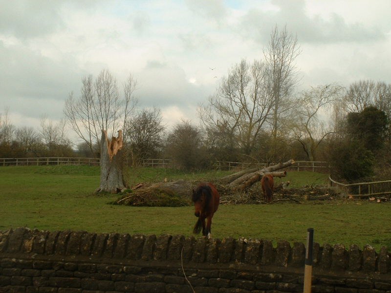
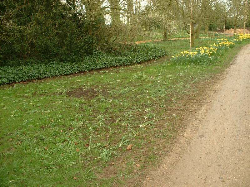
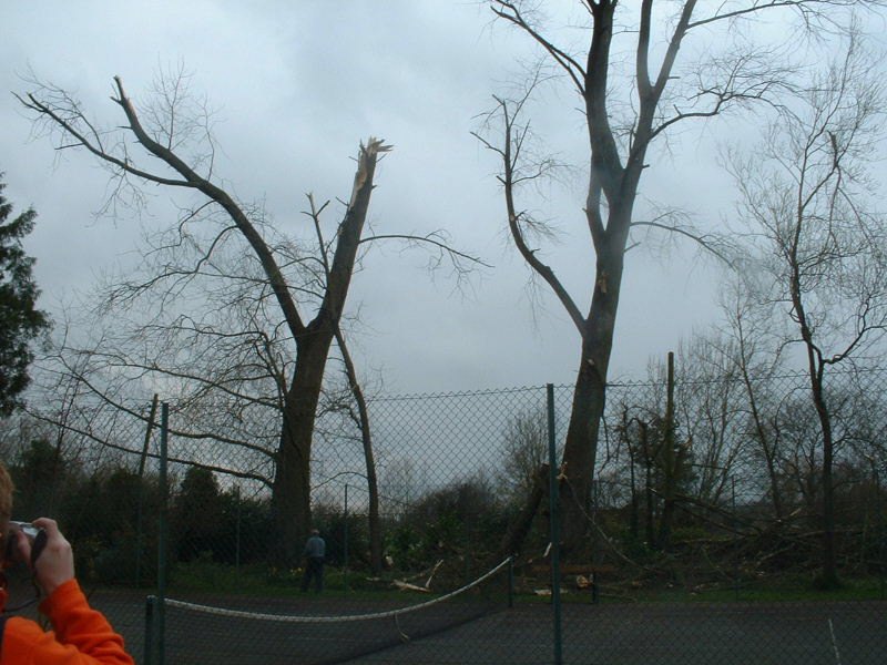
In the grounds of Broughton Poggs Manor, the tornado's passing was very evident. In one place, the path of the vortex may be clear to see, as daffodils lay flat for some distance, before suddenly remaining untouched. The flattened flowers were in a southerly direction, although any manner of secondary wind or small vortex may have caused this. In the same area, another tree lies in a sorry state, with the lumber machines already waiting to take away the damaged tree. This tree fell in a north-easterly direction.
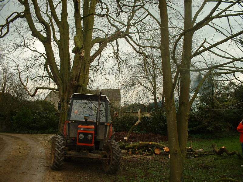
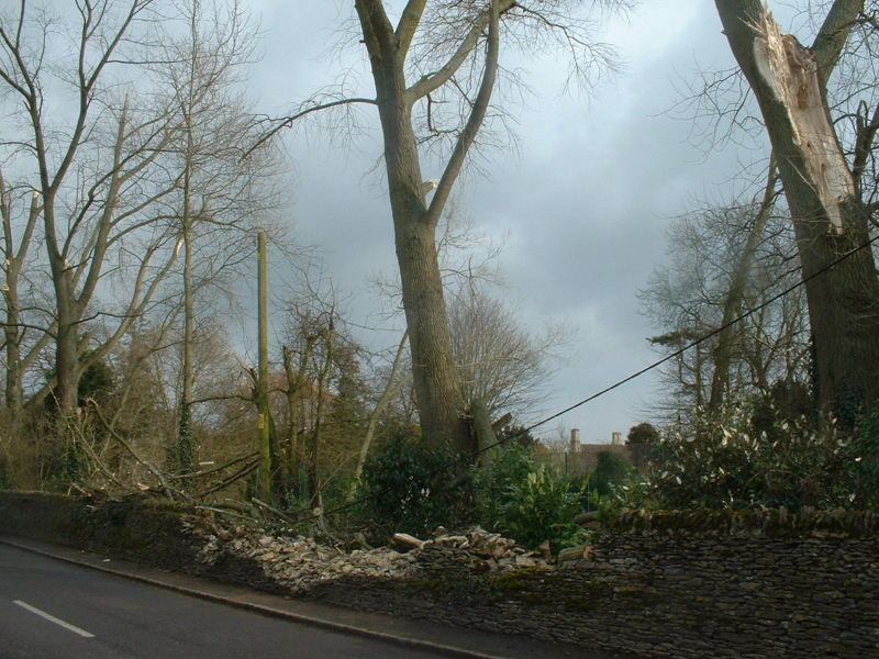
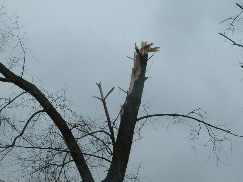
A view northwards gave another angle of the massive trees which blocked the road for a few days after the tornado. In the first image below, the tree surgeon surveys the damage caused to the trees. In the second image, the alleged "twisting" motion of the trees from one eye-witness seems to hold true, as the sheared top of this tree does seem to have been twisted prior to snapping.
(4)
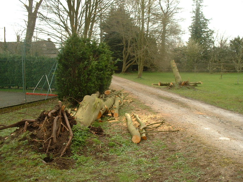
These two trees had a diamater of about a foot, and were thus not the largest of trees. However, they were both toppled in exactly the same direction, as measured using a hand-held GPS. Not only were they blown over, but their entire root balls were heaved out of the ground. Both of these trees fell in a north-easterly direction.
So the start to our investigation had revealed widespread damage to trees, walls and powerlines in Broughton Poggs, immediately to the west of Filkins. From our initial conclusions, all the damage saw the debris spread in an east to north-easterly direction, and this would indicate very strong westerly winds. If this was a tornado, then the southern edge of the vortex would have passed through this region, as this is where the strongest winds are found.
The next step was to travel east into the village of Filkins, located in the path of this westerly wind.